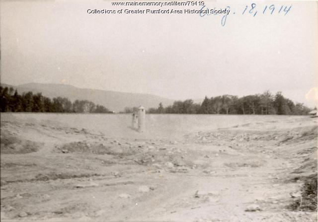
Contributed by Greater Rumford Area Historical Society

- MMN #79419
- print page
- download web image
Purchase a reproduction of this item on VintageMaineImages.com.
Description
This photograph shows the completed, but empty, reservoir on Mt. Zircon Brook. The Mt. Zircon Dam measured 847 feet long and 57 feet high at the center, with a concrete core wall, four feet thick the entire length of it, set on solid ledge.
The drainage area of the watershed is 2.6 square miles and its tributary was the Mt. Zircon Brook. The famous Mt. Zircon moontide springs are located and spill over within the watershed.
About This Item
- Title: Mt. Zircon Reservoir, Rumford, 1914
- Creation Date: 1914-08-18
- Subject Date: 1914-08-18
- Location: RHS, Rumford, Oxford County, ME
- Media: Photographic print
- Object Type: Image
Cross Reference Searches
Standardized Subject Headings
For more information about this item, contact:
Greater Rumford Area Historical Society145 Congress Street, Rumford, ME 04276
(207) 364-2540
The copyright and related rights status of this item have not been evaluated. Please contact the contributing repository for more information.
Please post your comment below to share with others. If you'd like to privately share a comment or correction with MMN staff, please send us a message with this link.

