Contributed by Maine Historical Society

- MMN #16128
- print page
- download web image
Purchase a reproduction of this item on VintageMaineImages.com.
Description
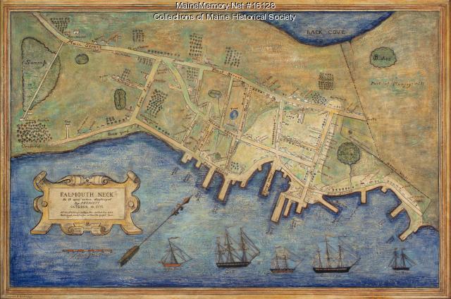
Maine artist Mildred Burrage painted version of the map of Falmouth Neck as it was when destroyed by Mowat October 18, 1775. The map originally was created in 1850 and published by Bailey & Noyes of Portland.
Burrage was a renowned artist who, in her early years, studied in France and met Monet. She had a keen interest in history and maps, and a number of her paintings feature map elements.
About This Item
- Title: Mildred Burrage's painted map of 1775 destroyed Falmouth Neck, 1925
- Creator: Mildred Burrage
- Creation Date: circa 1925
- Subject Date: 1775-10-18
- Location: Portland, Cumberland County, ME
- Media: Painted gesso
- Dimensions: 107 cm x 155 cm
- Local Code: 2004.314
- Object Type: Image
Cross Reference Searches
Standardized Subject Headings
- Burrage, Mildred G. (Mildred Giddings), 1890-1983
- Falmouth (Me.)--Burning by the British, 1775--Maps
- Portland (Me.)--Maps
- United States--History--Revolution, 1775-1783--Maps--Paintings
People
For more information about this item, contact:
Maine Historical Society485 Congress Street, Portland, ME 04101
(207) 774-1822 x230
Website
This Item is protected by copyright and/or related rights. No Permission is required to use the low-resolution watermarked image for educational use, or as allowed by the applicable copyright. For all other uses, permission is required.
More to Consider
Please post your comment below to share with others. If you'd like to privately share a comment or correction with MMN staff, please send us a message with this link.


