Contributed by Bruce Thurlow through Scarborough Historical Society & Museum
Description
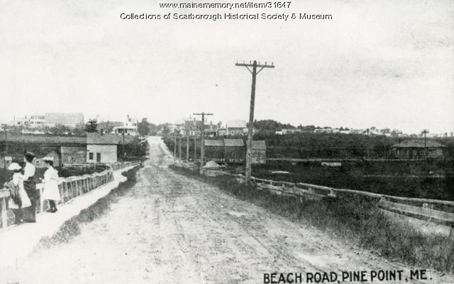
This section of Pine Point road is between the present Clambake Restaurant to Leavitt Brother's Plant. Note the wooden walkway for people to use located between the beach and the railroad station. The road is unpaved and shows the hill to Blue Point before the overpass was built. The marsh lands behind the station exist today, but as one goes south to Pine Point, the Clambake Restaurant and related buildings are located on what was marsh land.
About This Item
- Title: Pine Point Road, Scarborough, ca. 1907
- Creator: Bill Bayley
- Creation Date: circa 1907
- Subject Date: circa 1907
- Location: Pine Point, Scarborough, Cumberland County, ME
- Media: Photographic print
- Dimensions: 20.3 cm x 27.9 cm
- Object Type: Image
Cross Reference Searches
Standardized Subject Headings
- Restaurants--Maine--Scarborough
- Pine Point Road (Scarborough, Me.)
- Dirt roads--Maine--Scarborough
- Railroad stations--Maine--Scarborough
- Wooden sidewalks--Maine--Scarborough
Other Keywords
For more information about this item, contact:
Scarborough Historical Society & MuseumPO Box 156, Scarborough, ME 04070-0156
(207) 885-9997
The copyright and related rights status of this item have not been evaluated. Please contact the contributing repository for more information.
Please post your comment below to share with others. If you'd like to privately share a comment or correction with MMN staff, please send us a message with this link.

