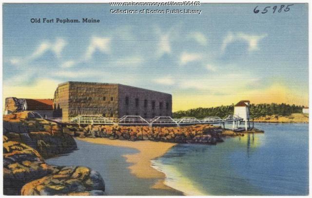
Contributed by Boston Public Library

- MMN #66463
- print page
- download web image
Purchase a reproduction of this item on VintageMaineImages.com.
Description
Fort Popham is a Civil War era structure built on the site of the short-lived Popham Colony settlement of 1607. Both are named for George Popham, the colony’s leader.
Because of its strategic location at the mouth of the Kennebec River and the Gulf of Maine, the US government used the area for military protection during the Revolutionary War, the War of 1812, the Civil War, the Spanish-American War and World War I.
Construction of Fort Popham began in 1861, using granite blocks quarried on nearby Fox and Dix islands. In 1869 construction at Fort Popham stopped, and the fort was never completed.
About This Item
- Title: Fort Popham, Phippsburg, ca. 1935
- Creator: Tichnor Bros., Inc.
- Creation Date: circa 1935
- Subject Date: circa 1935
- Location: Fort Popham, Phippsburg, Sagadahoc County, ME
- Media: Linen texture postcard
- Dimensions: 9 cm x 14 cm
- Collection: The Tichnor Brothers Collection
- Object Type: Text and Image
Cross Reference Searches
Standardized Subject Headings
- Fort Popham (Me.)
- United States--Army--Fort Popham (Me.)
- Beaches--Maine--Phippsburg
- Forts & fortifications--Maine--Phippsburg
People
Other Keywords
For more information about this item, contact:
Boston Public Library700 Boylston Street, Boston, MA 02116
(617) 859-2039
Website
This Item is protected by copyright and/or related rights. No Permission is required to use the low-resolution watermarked image for educational use, or as allowed by the applicable copyright. For all other uses, permission is required.
Please post your comment below to share with others. If you'd like to privately share a comment or correction with MMN staff, please send us a message with this link.
