Keywords: West Brunswick
Item 11723

Contributed by: Maine Historical Society Date: 1747-07-06 Location: Brunswick Media: Ink on paper
Item 11714
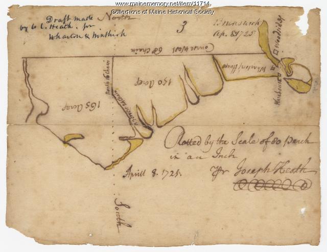
Contributed by: Maine Historical Society Date: 1725-04-08 Location: Brunswick Media: Ink on paper

Exhibit

For the Union: Civil War Deaths
More than 9,000 Maine soldiers and sailors died during the Civil War while serving with Union forces. This exhibit tells the stories of a few of those men.
Exhibit

Anglo-Americans in northern New England sometimes interpreted their own anxieties about the Wilderness, their faith, and their conflicts with Native Americans as signs that the Devil and his handmaidens, witches, were active in their midst.

Site Page

"… (1754-1824), loyalist of Massachusetts and New Brunswick. Both men served on multiple border commissions, and their impact was extended since each…"
Site Page

"… sides) and to preserve an overland route from New Brunswick to Quebec (for the British). The costs to raise and support the surveying teams in…"

Story

Choosing a Career in Country and Bluegrass Music
by Ken Brooks
How I became a country and bluegrass musician
Story
An enjoyable conference, Portland 2021
by John C. Decker, Danville, Pennsylvania
Some snippets from a 4-day conference by transportation historians in Portland, September 7-11, 2021
