Keywords: land division
Item 102068
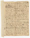
"Tract of land lying in Poland," 1798
Contributed by: Maine Historical Society Date: 1798 Location: Auburn; Poland; Minot; Turner Media: Ink on paper
Item 108765
Edward Little plan of lots, ca. 1820
Contributed by: Maine Historical Society Date: circa 1820 Media: Ink on paper
Exhibit
Colonial Cartography: The Plymouth Company Maps
The Plymouth Company (1749-1816) managed one of the very early land grants in Maine along the Kennebec River. The maps from the Plymouth Company's collection of records constitute some of the earliest cartographic works of colonial America.
Exhibit
The boundaries of Maine are the product of international conflict, economic competition, political fights, and contested development. The boundaries are expressions of human values; people determined the shape of Maine.
Site Page
"Gendered divisions of economic activity, moreover, meant that women landowners did not participate in companies’ day-to-day decision-making or…"
Site Page
"Sale and division to heirs of the original proprietors meant that by 1750, both the Kennebec and Pejepscot Proprietors consisted of numerous men and…"
Story
Make It Great Again
by SC
2020, Acrylic on canvas
Story
August 12, 1967 was the most significant day of my life
by Bob Small
How the Vietnam war affected my life


