Keywords: plymouth
Item 29313
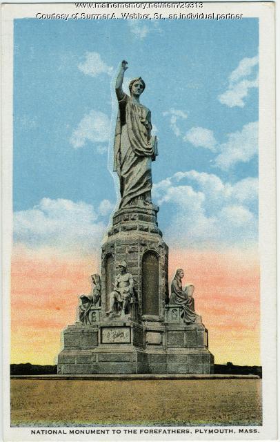
Forefather's Monument, Plymouth, Massachusetts, ca. 1889
Courtesy of Sumner A. Webber, Sr., an individual partner Date: circa 1889 Location: Plymouth; Hallowell Media: Postcard
Item 29249

National Monument to the Forefathers model, Hallowell, ca. 1889
Contributed by: Hubbard Free Library Date: 1889 Location: Plymouth Media: Photographic print

Item 37129

Bungalow, Colonial Avenue (subsequently Plymouth Street), Portland, 1924
Owner in 1924: Ellen I Allen Use: Bungalow
Item 37118

61-63 Colonial Avenue (subsequently Plymouth Street), Portland, 1924
Owner in 1924: Minnie L Messer Use: Bungalow

Item 151511

House for Bradford J. Johnson, Plymouth, New Hampshire, 1975
Contributed by: Maine Historical Society Date: 1975 Location: Plymouth Client: Bradford J. Johnson Architect: John Calvin Stevens II
Item 150310

Sketch for Cottage at Nantasket Beach, Hull, Massachusetts, 1885
Contributed by: Maine Historical Society Date: 1885 Location: Hull Client: unknown Architect: John Calvin Stevens

Exhibit

Colonial Cartography: The Plymouth Company Maps
The Plymouth Company (1749-1816) managed one of the very early land grants in Maine along the Kennebec River. The maps from the Plymouth Company's collection of records constitute some of the earliest cartographic works of colonial America.
Exhibit

The boundaries of Maine are the product of international conflict, economic competition, political fights, and contested development. The boundaries are expressions of human values; people determined the shape of Maine.

Site Page

"The Plymouth Company (Kennebec Proprietors) records, ca. 1625-1824 Kennebec Purchase Deed, October 27, 1661Maine Historical Society The…"
Site Page

Beyond Borders - Mapping Maine and the Northeast Boundary - Kennebec Proprietors Biographies
"… Colony of New-Plymouth" and their common name "Plymouth Company" was intentionally tied to the Plymouth Colony to justify their claim."
