Keywords: town maps
Item 62841
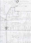
Map of "The Plains," Waterville, 1911
Contributed by: Waterville Public Library Date: 1911 Location: Waterville Media: Ink on paper
Item 105434
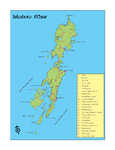
Map of the town of Thomaston, 1855
Contributed by: Osher Map Library and Smith Center for Cartographic Education Date: 1855 Location: Thomaston Media: Lithograph
Item 150052
Penobscot Shoe Company building, Old Town, 1952-1954
Contributed by: Maine Historical Society
Date: 1952–1954
Location: Old Town
Client: Penobscot Shoe Company
Architect: Eaton W. Tarbell
This record contains 2 images.
Item 150166
Bangor-Old Town Municipal Airport, Bangor, 1945-1948
Contributed by: Maine Historical Society Date: 1945–1948 Location: Bangor Client: Cities of Bangor and Old Town Architect: Eaton W. Tarbell
Exhibit
Colonial Cartography: The Plymouth Company Maps
The Plymouth Company (1749-1816) managed one of the very early land grants in Maine along the Kennebec River. The maps from the Plymouth Company's collection of records constitute some of the earliest cartographic works of colonial America.
Exhibit
The Establishment of the Troy Town Forest
Seavey Piper, a selectman, farmer, landowner, and leader of the Town of Troy in the 1920s through the early 1950s helped establish a town forest on abandoned farm land in Troy. The exhibit details his work over ten years.
Site Page
Farmington: Franklin County's Shiretown - Maps
"Farmington Town Map, 1794 Farmington Downtown Map, circa 1860 Farmington Topographical Map, 1924 Abbott Park Original Design Map "Paths" in Google…"
Site Page
Historic Hallowell - Train Wreck Map
"… Train Wreck Map Map X"
Story
Redlining and the Jewish Communities in Maine
by David Freidenreich
Federal and state policies created unfair housing practices against immigrants, like redlining.
Story
John Coyne from Waterville Enlists as a Railroad Man in WWI
by Mary D. Coyne
Description of conditions railroad men endured and family background on John Coyne.


