Category: Nature & Geography
- Historical Items (4973)
- Tax Records (0)
- Architecture & Landscape (0)
- Online Exhibits (43)
- Site Pages (678)
- My Maine Stories (55)
- Lesson Plans (8)
Historical Items
These results include photographs, documents, letters, paintings, artifacts, and many other kinds of Maine related items from collections around the state and elsewhere.
Item 12626

Mereconege Neck, Harpswell, ca. 1780
Contributed by: Maine Historical Society Date: circa 1760 Location: Harpswell Media: Ink on paper
Item 12627

Merryconeag and Maquoit marshes, ca. 1730
Contributed by: Maine Historical Society Date: circa 1730 Location: Brunswick Media: Ink on paper
Item 12628

Contributed by: Maine Historical Society Date: 1741-08-06 Location: Brunswick Media: Ink on paper
Item 12629

Contributed by: Maine Historical Society Date: 1738-01-09 Location: Phippsburg Media: Ink on paper
Item 12630

Upper end of Long Reach, Bath, 1728
Contributed by: Maine Historical Society Date: 1728-11-18 Location: Bath Media: Ink on paper
Item 12850

Tract of land belonging to Sylvester Gardiner, Bath, 1764
Contributed by: Maine Historical Society
Date: 1764-12-08
Location: Georgetown; Bath
Media: Ink on paper
This record contains 2 images.
Item 12851

Contributed by: Maine Historical Society
Date: 1798
Media: Ink on paper
This record contains 2 images.
Item 12852

Kennebec River above Fort Western, ca. 1800
Contributed by: Maine Historical Society
Date: circa 1800
Media: Ink on paper
This record contains 2 images.
Item 12855

Plan of Cumberland and Lincoln counties, 1773
Contributed by: Maine Historical Society
Date: 1773
Media: Ink on paper
This record contains 2 images.
Item 12886

James Bowdoin's property, Lisbon, ca. 1770
Contributed by: Maine Historical Society Date: circa 1770 Location: Lewiston; Lisbon Media: Ink on paper
Item 12933

Wing's Mill Pond settlers' lots, ca. 1795
Contributed by: Maine Historical Society
Date: circa 1795
Location: Belgrade
Media: Ink on paper
This record contains 2 images.
Item 12937
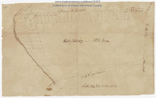
Map of lot no. 7, 135 acres on Madison Road, Skowhegan, ca. 1760
Contributed by: Maine Historical Society
Date: circa 1760
Location: Skowhegan
Media: Ink on paper
This record contains 2 images.
Item 12943

Plan of lots on the Sheepscot River, Alna, 1798
Contributed by: Maine Historical Society
Date: 1759
Location: Alna
Media: Ink on paper
This record contains 2 images.
Item 13331

Red Bridge, Jackson Falls, Houlton, 1890
Contributed by: Aroostook County Historical and Art Museum Date: 1890-10-05 Location: Houlton Media: Photographic print
Item 16542

Rangley Lakes region map, 1876
Contributed by: Maine Historical Society Date: 1876 Media: Ink on paper
Item 17395

Sketch with Camera Lucida, ca. 1841
Contributed by: Maine Historical Society Date: circa 1841 Media: Transparency
Item 17396

Camera Lucida sketch, ca. 1841
Contributed by: Maine Historical Society Date: circa 1841 Media: Transparency
Item 19108

Contributed by: Jesup Memorial Library Date: circa 1911 Location: Bar Harbor Media: Postcard
Item 20309

Lincoln Park, Portland, ca. 1886
Contributed by: Maine Historical Society Date: circa 1886 Location: Portland Media: Photographic print
Item 21566

Contributed by: Maine Historical Society Date: 1687 Location: North Yarmouth Media: Ink on paper
Item 22240

View from Robinson's Mountain, ca. 1885
Contributed by: Great Harbor Maritime Museum Date: circa 1885 Location: Mount Desert; Southwest Harbor Media: Photographic print
Item 22252

Ocean Drive, Acadia National Park, ca. 1950
Contributed by: Great Harbor Maritime Museum Date: circa 1950 Location: Mount Desert; Bar Harbor Media: Photographic print
Item 22254

Thunder Hole, Acadia National Park, ca. 1950
Contributed by: Great Harbor Maritime Museum Date: circa 1950 Location: Mount Desert; Bar Harbor Media: Photographic print
Item 22671

Snow storm, High Street, Brunswick, 1887
Contributed by: Pejepscot History Center Date: 1887 Location: Brunswick Media: Photographic print
