Keywords: Historical Map
- Historical Items (596)
- Tax Records (0)
- Architecture & Landscape (275)
- Online Exhibits (34)
- Site Pages (168)
- My Maine Stories (2)
- Lesson Plans (5)
Historical Items
These results include photographs, documents, letters, paintings, artifacts, and many other kinds of Maine related items from collections around the state and elsewhere.
Item 108766

Plan of lot no. 1, Lewiston, ca. 1800
Contributed by: Maine Historical Society Date: circa 1800 Location: Lewiston Media: Ink on paper
Item 100208

Plan of Falmouth as it appeared in 1775
Contributed by: Maine Historical Society Date: 1775 Location: Portland Media: Ink on paper
Item 11728

Plan of a road in Brunswick, 1764
Contributed by: Maine Historical Society Date: 1764 Location: Brunswick; Bath Media: Ink on paper
Item 5314

Plan of rivers of Saco and Kennebunk, 1731
Contributed by: Maine Historical Society Date: 1731 Media: Ink on paper
Item 12944

Contributed by: Maine Historical Society
Date: 1764
Location: Sidney
Media: Ink on paper
This record contains 2 images.
Item 110907

Contributed by: Maine Historical Society
Date: circa 1812
Location: Waterville
Media: Ink on paper
This record contains 2 images.
Item 5960

Fort land for William Ross, Brunswick, ca. 1763
Contributed by: Maine Historical Society Date: circa 1763 Location: Brunswick Media: Ink on paper
Item 12939

Henry May, James Larking lot, near the Sheepscot River, 1805
Contributed by: Maine Historical Society
Date: 1805-11-25
Media: Ink on paper
This record contains 2 images.
Item 12631

Five farm lots, Bowdoinham, 1718
Contributed by: Maine Historical Society Date: 1718 Location: Bowdoinham Media: Ink on paper
Item 11754

Plan for towns along the Androscoggin River, ca. 1760
Contributed by: Maine Historical Society Date: circa 1760 Location: Livermore Falls; Canton; Mexico; Jay; Leeds Media: Ink on paper
Item 108750

Contributed by: Maine Historical Society
Date: 1834-10-02
Location: Leeds
Media: Ink on paper
This record contains 3 images.
Item 12852

Kennebec River above Fort Western, ca. 1800
Contributed by: Maine Historical Society
Date: circa 1800
Media: Ink on paper
This record contains 2 images.
Item 108764

Plan of suit, Little v. Field, 1823
Contributed by: Maine Historical Society Date: 1823 Media: Ink on paper
Item 110945

International water boundary between the United States and the Dominion of Canada, ca. 1893
Contributed by: Maine Historical Society
Date: 1893
Media: Ink on paper
This record contains 4 images.
Item 12888

Yarmouth, North Yarmouth and Freeport, 1727
Contributed by: Maine Historical Society Date: 1727-12-19 Location: Freeport; Yarmouth; North Yarmouth Media: Ink on paper
Item 10067

Contributed by: Maine Historical Society Date: circa 1780 Location: Gray Media: Ink on paper
Item 11922

Contributed by: Maine Historical Society Date: 1752-08-26 Location: Brunswick Media: Ink on paper
Item 12203

Benjamin and Nehemiah Turner's plan containing 200 acres, Palermo, 1806
Contributed by: Maine Historical Society
Date: 1806-06-18
Location: Palermo
Media: Ink on paper
This record contains 2 images.
Item 11926
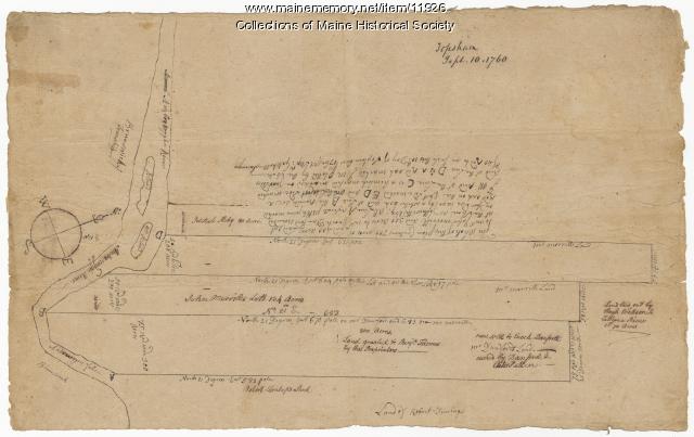
Morrill and Danforth lots, Topsham, 1760
Contributed by: Maine Historical Society
Date: 1760-09-10
Location: Topsham
Media: Ink on paper
This record contains 2 images.
Item 12178

Moses Greenleaf vertical sections, 1829
Contributed by: Maine Historical Society Date: 1829 Media: Ink on paper
Item 11750

Contributed by: Maine Historical Society Date: 1770 Location: Durham Media: Ink on paper
Item 108752

Plan of William Libby's lot, Durham, 1819
Contributed by: Maine Historical Society Date: 1819-12-08 Location: Durham Media: Ink on paper
Item 108751

50 acres bargained, Leeds, 1834
Contributed by: Maine Historical Society
Date: 1834-10-02
Location: Leeds
Media: Ink on paper
This record contains 3 images.
Item 108754

Plan excepting a road to Durham, 1821
Contributed by: Maine Historical Society Date: 1821-06-29 Location: Durham Media: Ink on paper
