Keywords: Historical Map
- Historical Items (595)
- Tax Records (0)
- Architecture & Landscape (275)
- Online Exhibits (34)
- Site Pages (168)
- My Maine Stories (2)
- Lesson Plans (5)
Historical Items
These results include photographs, documents, letters, paintings, artifacts, and many other kinds of Maine related items from collections around the state and elsewhere.
Item 22490

Contributed by: Maine Historical Society Date: 1851 Location: Cape Elizabeth Media: Ink on paper, map
Item 11718

Contributed by: Maine Historical Society Date: circa 1740 Location: Brunswick Media: Ink on paper
Item 11974

John Merrill lot, Topsham, 1762
Contributed by: Maine Historical Society Date: 1762 Location: Topsham Media: Ink on paper
Item 12630

Upper end of Long Reach, Bath, 1728
Contributed by: Maine Historical Society Date: 1728-11-18 Location: Bath Media: Ink on paper
Item 4182

Plan of Rascoheegan alias Parker's Island, 1759
Contributed by: Maine Historical Society Date: 1759 Location: Georgetown Media: Ink on paper
Item 12197
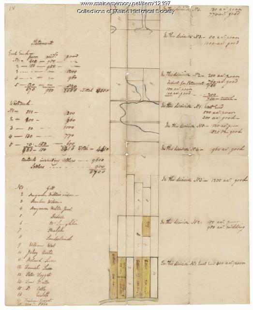
Division of the Tyng and Lowell estates, ca. 1760
Contributed by: Maine Historical Society
Date: circa 1760
Media: Ink on paper
This record contains 2 images.
Item 6849

Contributed by: Maine Historical Society Date: 1794 Location: Augusta; Hallowell Media: Ink on paper
Item 11929
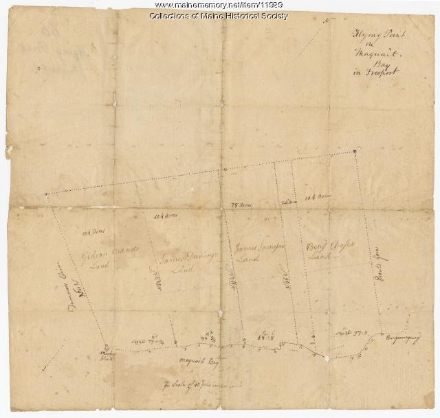
Flying Point at Maquoit Bay, Freeport, ca. 1770
Contributed by: Maine Historical Society Date: circa 1770 Location: Freeport; Brunswick Media: Ink on paper
Item 4173

Contributed by: Maine Historical Society Date: 1866 Location: Portland Media: Ink on paper
Item 68913

Scarborough landowners, ca. 1800
Contributed by: Maine Historical Society Date: circa 1800 Location: Scarborough Media: Ink on paper
Item 68872

Plan of farm, Scarborough, 1741
Contributed by: Maine Historical Society Date: 1741 Location: Cape Elizabeth Media: Ink on paper
Item 108844

Plan of lots in Georgetown, 1759
Contributed by: Maine Historical Society
Date: 1759-03-14
Location: Bath
Media: Ink on paper
This record contains 2 images.
Item 116515

St. John River boundary survey, from Rose Island north and east, 1844
Contributed by: Maine Historical Society Date: 1844 Media: Ink on paper
Item 37701

Contributed by: Maine Historical Society
Date: circa 1750
Media: Ink on paper
This record contains 2 images.
Item 7950

Islands in Passamaquoddy Bay, ca. 1800
Contributed by: Maine Historical Society
Date: circa 1800
Media: Ink on paper
This record contains 2 images.
Item 11975

Plan of Ruscohegon Alias Parker's Island, Georgetown, 1759
Contributed by: Maine Historical Society
Date: 1759-03-22
Location: Georgetown
Media: Ink on paper
This record contains 2 images.
Item 23336

Contributed by: Maine Historical Society Date: 1793 Location: Porter; Brownfield Media: Ink on paper
Item 100209

Falmouth Neck as Destroyed, 1880
Contributed by: Maine Historical Society Date: 1775-10-18 Location: Portland Media: Ink on paper
Item 35621
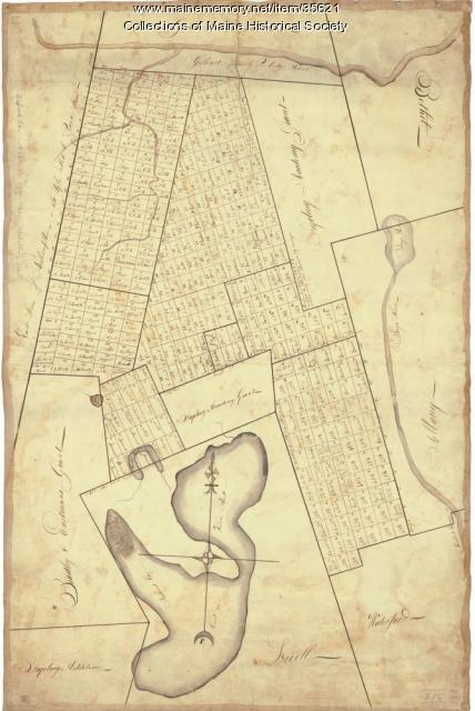
Contributed by: Maine Historical Society Date: circa 1792 Location: Stoneham; Lovell; Bethel; Albany; Mason Twp.; Bachelders Grant Media: Ink on fabric
Item 68873

Zebulon Libbey's land, Scarborough, 1769
Contributed by: Maine Historical Society Date: 1769 Location: Scarborough Media: Ink and wash on paper
Item 12851

Contributed by: Maine Historical Society
Date: 1798
Media: Ink on paper
This record contains 2 images.
Item 6846

Plan of Saint Croix River, Calais, 1807
Contributed by: Maine Historical Society Date: 1807 Location: Calais Media: Ink on paper
Item 11721

Plan of Land at Brunswick Narrows, 1741
Contributed by: Maine Historical Society Date: 1741 Location: Brunswick Media: Ink on paper
Item 116537

St. John River boundary survey no. 2, 1843
Contributed by: Maine Historical Society Date: 1843 Media: Ink on paper
