Keywords: Survey of Maine
- Historical Items (508)
- Tax Records (4)
- Architecture & Landscape (141)
- Online Exhibits (29)
- Site Pages (91)
- My Maine Stories (2)
- Lesson Plans (0)
Historical Items
These results include photographs, documents, letters, paintings, artifacts, and many other kinds of Maine related items from collections around the state and elsewhere.
Item 116458
Contributed by: Acadian Archives Date: 1991-06-17 Location: Frenchville Media: Photograph
Item 9259
Early map of the Salmon Falls River in Lebanon, 1766
Contributed by: Maine Historical Society Date: 1766 Location: Lebanon Media: Ink on paper
Item 12382
Plan of Kennebeck River, ca. 1765
Contributed by: Maine Historical Society
Date: circa 1765
Media: Ink on paper
This record contains 2 images.
Item 29252
Spring and Summer, Hallowell Granite Works, ca. 1900
Contributed by: Hubbard Free Library Date: circa 1900 Location: Hallowell Media: Photographic print
Item 5335
Brunswick and Topsham, ca. 1730
Contributed by: Maine Historical Society Date: circa 1730 Location: Brunswick; Topsham Media: Ink on paper
Item 148738
Proposed Windy Ledges holding ground, Fort Kent, 1928
Contributed by: Maine Historical Society Date: 1928 Location: Fort Kent; St. John; St. Francis Parish Media: Ink on linen; hand coloring; graphite on linen
Item 11721
Plan of Land at Brunswick Narrows, 1741
Contributed by: Maine Historical Society Date: 1741 Location: Brunswick Media: Ink on paper
Item 16541
Map of lakes of Franklin and Oxford counties, 1876
Contributed by: Maine Historical Society Date: 1876 Media: Ink on paper
Item 7197
Joseph Chandler letter to the Kennebec Proprietors, 1808
Contributed by: Maine Historical Society Date: 1808-04-08 Location: Monmouth Media: Ink on paper
Item 105268
Contributed by: Osher Map Library and Smith Center for Cartographic Education Date: 1875 Location: Belfast Media: Lithograph
Item 116455
Acadian ship's knee joint, Van Buren, 1991
Contributed by: Acadian Archives Date: 1991-06-27 Location: Van Buren Media: photographic print
Item 5741
Detail from a Map of Portland Harbour and islands, 1825
Contributed by: Maine Historical Society Date: 1825 Location: Portland Media: Ink on paper, jpg
Item 26628
The Stimpson House, Thomaston, ca. 1960
Contributed by: Thomaston Historical Society Date: circa 1960 Location: Thomaston Media: Photographic print
Item 110867
"Plan of a tract of land lying 15 English miles on each side of Kennebeck River," 1751
Contributed by: Maine Historical Society
Date: 1751
Media: Ink on paper
This record contains 10 images.
Item 8271
Contributed by: Patten Lumbermen's Museum Date: circa 1900 Media: Photographic print
Item 26626
The Hallowell House, Thomaston, ca. 1960
Contributed by: Thomaston Historical Society Date: circa 1960 Location: Thomaston Media: Photographic print
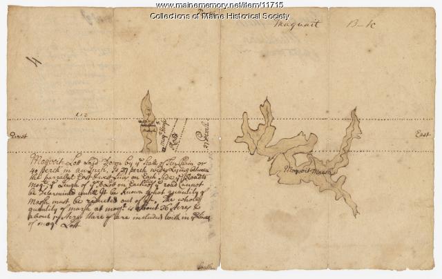
Item 11715
Plan of Maquoit Meadows, ca. 1720
Contributed by: Maine Historical Society Date: circa 1720 Location: Brunswick Media: Ink on paper
Item 20763
Penobscot River and Chesuncook Lake, 1820
Contributed by: Maine Historical Society Date: 1820 Media: Ink on paper
Item 62059
Flooded street in Winslow, 1936
Contributed by: Waterville Public Library Date: 1936 Location: Winslow Media: Photographic print
Item 148978
Map of Township 3 Range 9, ca. 1915
Contributed by: Maine Historical Society Date: circa 1915 Location: T3 R9 WELS Media: Ink on linen; hand coloring
Item 148979
Map of Township 8, Range 11, ca. 1915
Contributed by: Maine Historical Society Date: circa 1915 Location: T8 R11 WELS Media: Ink on linen
Item 148980
Map of Township 10 Range 8, ca. 1915
Contributed by: Maine Historical Society Date: circa 1915 Location: T10 R8 Media: Ink on linen
Item 25630
Hill Farm, Pownal State School, ca. 1953
Contributed by: New Gloucester Historical Society Date: circa 1953 Location: New Gloucester Media: Ink on paper, photograph
Item 11779
Plan of a section of Portland called The Oaks, ca. 1845
Contributed by: Maine Historical Society Date: circa 1845 Location: Portland Media: Ink on paper, map


