Keywords: Atlas
- Historical Items (64)
- Tax Records (1)
- Architecture & Landscape (1)
- Online Exhibits (5)
- Site Pages (8)
- My Maine Stories (0)
- Lesson Plans (0)
Historical Items
These results include photographs, documents, letters, paintings, artifacts, and many other kinds of Maine related items from collections around the state and elsewhere.
Item 59802
Brunswick to Bath electric railroads, ca. 1937
Contributed by: Seashore Trolley Museum Date: circa 1937 Location: Bath; Brunswick Media: Ink on paper
Item 105362
Contributed by: Osher Map Library and Smith Center for Cartographic Education Date: 1833 Media: Engraving
Item 6415
Pulpit Rock near Lewis Cove, Perry, 1836
Contributed by: Maine Historical Society Date: 1836-08-10 Location: Perry Media: Ink on paper
Item 6416
Mount Ktaadn from W. Butterfield's near the Grand Schoodic Lake, 1836
Contributed by: Maine Historical Society Date: 1836 Media: Ink on paper
Item 6419
Slate, greenstone trap-rocks, Quoddy-Head, 1836
Contributed by: Maine Historical Society Date: 1836 Location: Quoddy Media: Ink on paper
Item 6420
Lubec, Campobello from Eastport, 1837
Contributed by: Maine Historical Society Date: 1837 Location: Lubec; Campobello Island; Eastport Media: Ink on paper
Item 6421
View of Camden & Penobscot Bay, 1836
Contributed by: Maine Historical Society Date: 1836 Location: Camden Media: Ink on paper
Item 59804
Lewiston, Auburn, and Turner electric railroads, ca. 1928
Contributed by: Seashore Trolley Museum Date: circa 1928 Location: Lewiston; Auburn; Turner Media: Ink on paper
Item 59806
Sabattus Village to Dennis Hill electric railroads, ca. 1941
Contributed by: Seashore Trolley Museum Date: circa 1941 Location: Lewiston; Litchfield; Sabattus; Greene Media: Ink on paper
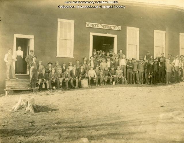
Item 99385
Veneer Products Company, Greenville, ca. 1930
Contributed by: Moosehead Historical Society Date: circa 1930 Location: Greenville Media: Photographic print
Item 105520
Contributed by: Osher Map Library and Smith Center for Cartographic Education Date: circa 1907 Location: Bar Harbor Media: Lithograph
Item 148290
Richard Anderson with an IAT blaze, Mars Hill, 1995
Contributed by: Maine Historical Society Date: 1995 Location: Mars Hill Media: Photographic print
Item 148308
Waterfall on Devil’s Bite trail, Newfoundland, Canada, 2009
Contributed by: Maine Historical Society Date: 2009 Location: Parson's Pond Media: Digital image
Item 148309
Contributed by: Maine Historical Society
Date: 2000
Media: Photographic print
This record contains 2 images.
Item 148317
Lewis Hills campsite, Newfoundland, Canada, 2009
Contributed by: Maine Historical Society Date: 2009 Media: Digital image
Item 16412
West Quoddy and Lighthouse, ca. 1837
Contributed by: West Quoddy Head Light Keepers Association Date: circa 1837 Location: West Quoddy; Lubec Media: Ink on paper
Item 33447
Main Street, Cumberland, ca. 1890
Contributed by: Cumberland Historical Society Date: circa 1890 Location: Cumberland Media: Photographic print
Item 59764
Kittery to York Beach electric railroad lines, ca. 1923
Contributed by: Seashore Trolley Museum Date: circa 1923 Location: York; Kittery Media: Ink on paper
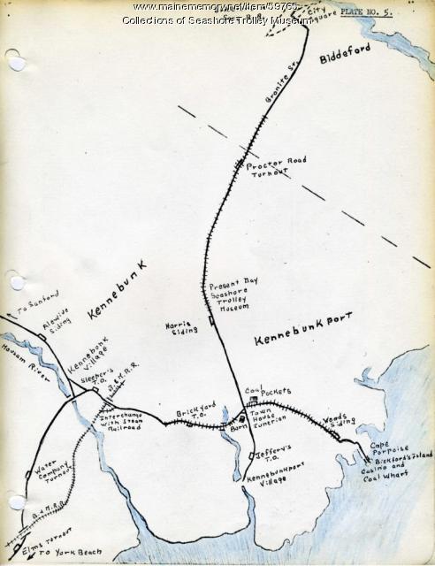
Item 59765
Kennebunk Village to Cape Porpoise electric railroads, ca. 1927
Contributed by: Seashore Trolley Museum Date: circa 1927 Location: Kennebunk; Cape Porpoise Media: Ink on paper
Item 59770
Portland, South Portland, & Cape Elizabeth electric railroads, ca. 1941
Contributed by: Seashore Trolley Museum Date: circa 1941 Location: Portland Media: Ink on paper
Item 59801
Freeport electric railroads map, ca. 1929
Contributed by: Seashore Trolley Museum Date: circa 1929 Location: Freeport Media: Ink on paper
Item 59807
Gardiner to Augusta to Winthrop electric railroads, ca. 1932
Contributed by: Seashore Trolley Museum Date: circa 1932 Location: Augusta; Winthrop; Gardiner; Manchester Media: Ink on paper
Item 59812
Rockland, Thomaston & Camden electric railroad lines, ca. 1931
Contributed by: Seashore Trolley Museum Date: circa 1931 Location: Rockport; Rockland; Thomaston; Owls Head; Camden Media: Ink on paper
Item 104604
New Map of English America, 1677
Contributed by: Osher Map Library and Smith Center for Cartographic Education Date: 1777 Media: Engraving


