Keywords: Colonial Map
- Historical Items (391)
- Tax Records (0)
- Architecture & Landscape (2)
- Online Exhibits (16)
- Site Pages (101)
- My Maine Stories (0)
- Lesson Plans (1)
Historical Items
These results include photographs, documents, letters, paintings, artifacts, and many other kinds of Maine related items from collections around the state and elsewhere.
Item 104938
"New England the Most Remarqueable Parts Thus Named," 1637
Contributed by: Osher Map Library and Smith Center for Cartographic Education Date: circa 1614 Media: Engraving
Item 109025
Manuscript map of Topsham Lots, 1763
Contributed by: Maine Historical Society Date: 1763 Location: Topsham Media: Ink on paper
Item 28982
Map of coastal Maine forts, 1723
Contributed by: Maine Historical Society Date: 1723 Media: Pencil on paper
Item 108862
Survey of lots for Peter Brown, Georgetown, 1761
Contributed by: Maine Historical Society Date: 1761-01-12 Location: Bath Media: Ink on paper
Item 108848
Map and petition, Sandy River, 1798
Contributed by: Maine Historical Society
Date: 1798
Location: New Vineyard; Farmington
Media: Ink on paper
This record contains 2 images.
Item 10545
Map of Ancient Falmouth from 1630 to 1690
Contributed by: Maine Historical Society Date: circa 1630 Location: Portland Media: Ink on paper
Item 108858
Plan of 200 acres on the Western Side of Kennebec River, Frankfort Plantation, 1758
Contributed by: Maine Historical Society
Date: 1758
Location: Dresden
Media: Ink on paper
This record contains 2 images.
Item 11722
Map of Brunswick, lots on Merrymeeting Bay, ca. 1750
Contributed by: Maine Historical Society
Date: circa 1750
Location: Brunswick
Media: Ink on paper
This record contains 2 images.
Item 12937
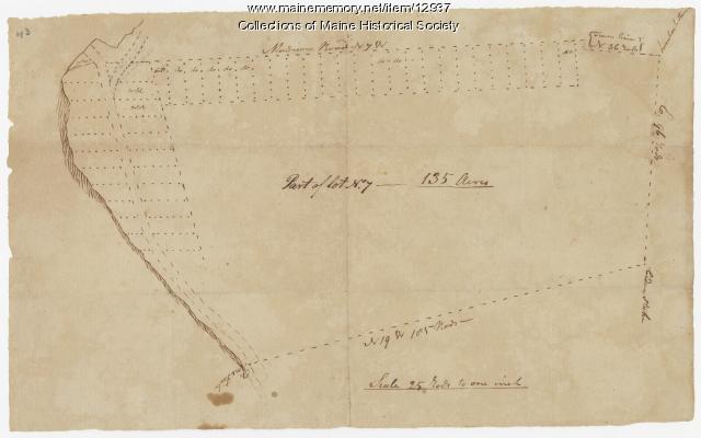
Map of lot no. 7, 135 acres on Madison Road, Skowhegan, ca. 1760
Contributed by: Maine Historical Society
Date: circa 1760
Location: Skowhegan
Media: Ink on paper
This record contains 2 images.
Item 149688
Contributed by: Acadian Archives Date: 1838 Media: Ink on paper
Item 116516
Extract from a Map of the British and French Dominions in North America, 1755
Contributed by: Maine Historical Society
Date: circa 1755
Media: Ink on paper
This record contains 2 images.
Item 12940
Map of lots G1 and G2 for James Pitts, near Clinton, 1769
Contributed by: Maine Historical Society
Date: 1769-11-07
Location: Skowhegan
Media: Ink on paper
This record contains 3 images.
Item 11924
Lots on Maquoit Road, Brunswick, 1761
Contributed by: Maine Historical Society Date: 1761 Location: Brunswick Media: Ink on paper
Item 110997
Map of the disputed portions of the New Brunswick and Lower Canada, 1839
Contributed by: Maine Historical Society
Date: 1839
Media: Ink on paper
This record contains 7 images.
Item 149687
Contributed by: Acadian Archives Date: circa 1831 Media: Ink on paper
Item 34145
Old Homesteads in Scarborough, ca. 1950
Contributed by: Scarborough Historical Society & Museum Date: circa 1950 Location: Scarborough; Scarborough Media: Ink on paper, photograph
Item 11943
Contributed by: Maine Historical Society Date: 1749-12-04 Location: Brunswick Media: Ink on paper
Item 105441
Machegonne : Portland, also called Falmouth, 1932
Contributed by: Osher Map Library and Smith Center for Cartographic Education Date: 1632–1932 Location: Portland; Falmouth Media: Lithograph
Item 4316
Plan of J. Robinson lot, Topsham, 1761
Contributed by: Maine Historical Society Date: 1761 Location: Topsham Media: Ink on paper
Item 5335
Brunswick and Topsham, ca. 1730
Contributed by: Maine Historical Society Date: circa 1730 Location: Brunswick; Topsham Media: Ink on paper
Item 4319
Contributed by: Maine Historical Society Date: circa 1795 Location: Freeport; New Gloucester; Brunswick Media: Ink on paper
Item 4325
"Brunswick in the late Province of Mayne in New England," 1719
Contributed by: Maine Historical Society
Date: 1718-01-28
Location: Brunswick
Media: Ink on paper
This record contains 2 images.
Item 11719
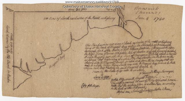
Contributed by: Maine Historical Society Date: 1740-06-04 Location: Brunswick Media: Ink on paper
Item 33847
Champlain's map of Saco Bay and the Saco River, 1605
Contributed by: McArthur Public Library Date: 1605 Location: Biddeford; Saco Media: Photographic print


