Keywords: Maine -- Boundaries -- Maps
- Historical Items (198)
- Tax Records (0)
- Architecture & Landscape (6)
- Online Exhibits (12)
- Site Pages (62)
- My Maine Stories (0)
- Lesson Plans (0)
Historical Items
These results include photographs, documents, letters, paintings, artifacts, and many other kinds of Maine related items from collections around the state and elsewhere.
Item 149688

Contributed by: Acadian Archives Date: 1838 Media: Ink on paper
Item 110949

Boundary survey between New Brunswick and Maine, 1842
Contributed by: Maine Historical Society Date: 1842 Media: Ink on paper
Item 110888

Map of the Northern part of the state of Maine and of the adjacent British Provinces, 1830
Contributed by: Maine Historical Society Date: circa 1830 Media: Ink on paper
Item 35633

Map of the state of Maine, 1843
Contributed by: Maine Historical Society Date: 1843 Media: Ink on paper
Item 105269

Map of Maine drawn by Sarah N. Young, 1822
Contributed by: Osher Map Library and Smith Center for Cartographic Education Date: 1822 Media: Ink on Paper
Item 105439

Plan of the village of Augusta, 1838
Contributed by: Osher Map Library and Smith Center for Cartographic Education Date: 1838 Location: Augusta Media: Lithograph
Item 105351

"Plan of the British and American positions, on the disputed territory by an eye witness," 1843
Contributed by: Osher Map Library and Smith Center for Cartographic Education Date: circa 1838 Media: Lithograph
Item 11786

Contested Northeast boundary map, 1843
Contributed by: Maine Historical Society Date: 1843 Media: Ink on paper
Item 116487

Canaan Corner, Northeast Boundary, ca. 1820
Contributed by: Maine Historical Society Date: circa 1820 Location: Canaan Media: Ink on paper
Item 8564

North shore, Lake Huron, ca. 1819
Contributed by: Maine Historical Society Date: circa 1819 Media: Ink on paper
Item 149686

Contributed by: Acadian Archives Date: circa 1835 Media: Ink on paper
Item 31883

Map of Cumberland County, 1880
Contributed by: North Yarmouth Historical Society Date: 1880 Media: Ink on paper
Item 116519

Map of Maine with northeast boundary lines, ca. 1850
Contributed by: Maine Historical Society Date: circa 1850 Media: Ink on paper
Item 11830

Map of the country explored, Maine and New Brunswick, ca. 1818
Contributed by: Maine Historical Society Date: 1817 Media: Ink on paper
Item 111027

Manuscript map of the Lake of the Woods, ca. 1820
Contributed by: Maine Historical Society Date: circa 1820 Media: Ink on paper
Item 111022

A plane chart of Rainy Lake, ca. 1820
Contributed by: Maine Historical Society Date: circa 1820 Media: Ink on paper
Item 11827
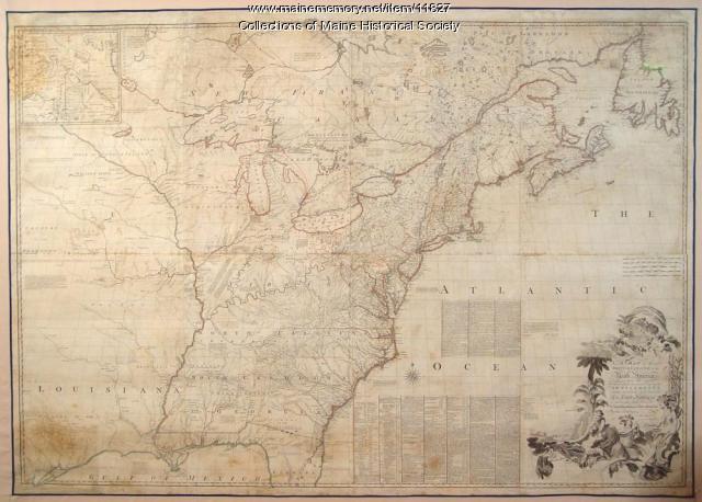
Map of the British and French North America, 1775
Contributed by: Maine Historical Society Date: 1755 Media: Ink on paper, map
Item 108959

Plat of a tract of land in Woolwich, 1751
Contributed by: Patten Free Library Date: 1751-11-29 Location: Woolwich Media: Watercolor on paper
Item 116540

Map of the boundary lines between the United States and the adjacent British provinces, 1843
Contributed by: Maine Historical Society Date: 1843 Media: Ink on paper
Item 136003

Small Maps & Miscellaneous Letters, Reports, and Memorandum, 1786–1826
Contributed by: Maine Historical Society Date: 1786–1826 Location: Madawaska Media: Ink on Paper
Item 116515

St. John River boundary survey, from Rose Island north and east, 1844
Contributed by: Maine Historical Society Date: 1844 Media: Ink on paper
Item 6843

A map of the boundary line explored in 1817
Contributed by: Maine Historical Society Date: 1817 Media: Ink on paper
Item 12178

Moses Greenleaf vertical sections, 1829
Contributed by: Maine Historical Society Date: 1829 Media: Ink on paper
Item 110997

Map of the disputed portions of the New Brunswick and Lower Canada, 1839
Contributed by: Maine Historical Society Date: 1839 Media: Ink on paper
