Keywords: early maps
- Historical Items (263)
- Tax Records (0)
- Architecture & Landscape (0)
- Online Exhibits (29)
- Site Pages (128)
- My Maine Stories (7)
- Lesson Plans (0)
Historical Items
These results include photographs, documents, letters, paintings, artifacts, and many other kinds of Maine related items from collections around the state and elsewhere.
Item 4177

Contributed by: Maine Historical Society Date: circa 1801 Media: Paper
Item 102071

Map of early Greene, Lewiston and Sabattus, ca. 1790
Contributed by: Maine Historical Society Date: circa 1790 Location: Sabattus; Greene Media: Ink on vellum
Item 12200

Maps of lots on the Androscoggin River, ca. 1760
Contributed by: Maine Historical Society Date: circa 1760 Location: Jay; Canton; Livermore Falls Media: Ink on paper
Item 5314

Plan of rivers of Saco and Kennebunk, 1731
Contributed by: Maine Historical Society Date: 1731 Media: Ink on paper
Item 102069

Early map of Lewiston, Auburn and Minot, 1820
Contributed by: Maine Historical Society Date: 1820 Location: Lewiston; Auburn; Minot Media: Ink on paper
Item 105628

Contributed by: Maine Historical Society Date: 1796 Media: Ink on paper
Item 11965

Contributed by: City of Portland Dept. of Public Works Date: 1773 Location: Portland Media: Ink on paper, map
Item 68866

Libby River land, Scarborough, 1794
Contributed by: Maine Historical Society Date: 1794 Location: Scarborough; Scarborough Media: Ink on paper, map
Item 18722

Modern rendering of John Small's map of Falmouth, 1753
Contributed by: Maine Historical Society Date: 1753 Location: Falmouth Media: Map, ink on paper
Item 4317

Cathance Mill lots, Topsham, 1759
Contributed by: Maine Historical Society Date: 1759-01-05 Location: Topsham Media: Ink on paper
Item 9259

Early map of the Salmon Falls River in Lebanon, 1766
Contributed by: Maine Historical Society Date: 1766 Location: Lebanon Media: Ink on paper
Item 11827
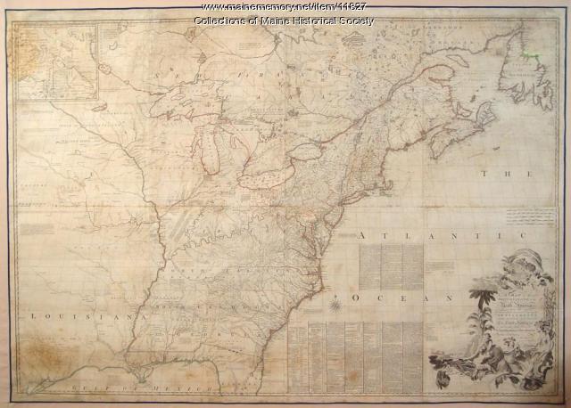
Map of the British and French North America, 1775
Contributed by: Maine Historical Society Date: 1755 Media: Ink on paper, map
Item 11730

Contributed by: Maine Historical Society Date: 1761-11-12 Location: Topsham Media: Ink on paper
Item 102070

Early map of Lewiston, Auburn and Minot, ca. 1820
Contributed by: Maine Historical Society Date: circa 1820 Location: Auburn; Lewiston; Minot Media: Ink on paper
Item 11732

Contributed by: Maine Historical Society Date: circa 1760 Location: Topsham Media: Ink on paper
Item 11725

Contributed by: Maine Historical Society Date: 1772 Location: Brunswick Media: Ink on paper
Item 58322

Copy of early Surry map, ca. 1880
Contributed by: Maine Historical Society Date: circa 1880 Location: Surry Media: Ink on paper
Item 4324

Androscoggin and Kennebec Rivers, ca. 1720
Contributed by: Maine Historical Society Date: circa 1720 Media: Ink on paper
Item 12937
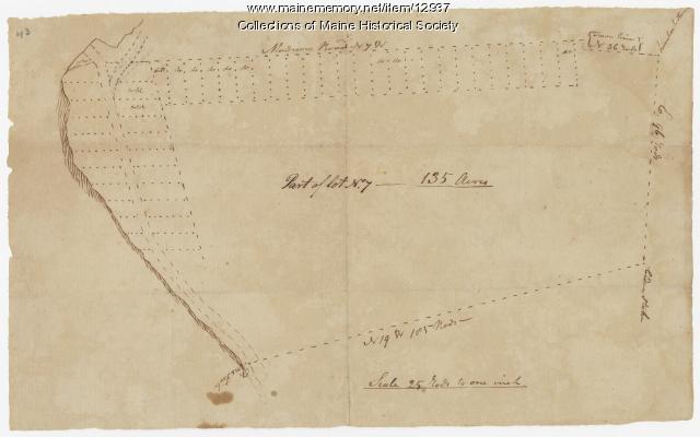
Map of lot no. 7, 135 acres on Madison Road, Skowhegan, ca. 1760
Contributed by: Maine Historical Society Date: circa 1760 Location: Skowhegan Media: Ink on paper
Item 17126
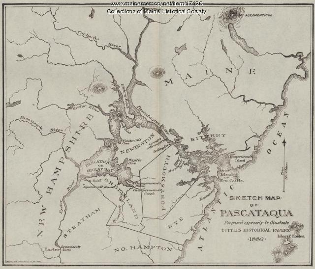
Sketch Map of Pascataqua, ca. 1690
Contributed by: Maine Historical Society Date: circa 1690 Media: Ink on paper, map
Item 5965

William Patten's land, Topsham, 1770
Contributed by: Maine Historical Society Date: 1770-05-28 Location: Topsham Media: Ink on paper
Item 100303

Harbour of Casco Bay, Portland, 1720
Contributed by: Tate House Museum Date: circa 1690 Location: Portland Media: Ink on paper
Item 34148

Black Point, Scarborough, ca. 1741
Contributed by: Scarborough Historical Society & Museum Date: circa 1741 Location: Scarborough Media: Paper on cardboard
Item 34145

Old Homesteads in Scarborough, ca. 1950
Contributed by: Scarborough Historical Society & Museum Date: circa 1950 Location: Scarborough; Scarborough Media: Ink on paper, photograph
