LC Subject Heading: Maine--Maps.
- Historical Items (194)
- Tax Records (0)
- Architecture & Landscape (1)
- Online Exhibits (0)
- Site Pages (0)
- My Maine Stories (0)
- Lesson Plans (0)
Historical Items
These results include photographs, documents, letters, paintings, artifacts, and many other kinds of Maine related items from collections around the state and elsewhere.
Item 35632
Map of the state of Maine, 1822
Contributed by: Maine Historical Society Date: 1822 Media: Ink on paper
Item 4174
Map of Portland and vicinity, 1900
Contributed by: Maine Historical Society Date: 1900 Location: Portland Media: Paper
Item 4175
Plan of the City of Portland, 1837
Contributed by: Maine Historical Society Date: 1837 Location: Portland Media: Paper
Item 9359
Maine, from the United States Gazetteer, 1795
Contributed by: Maine Historical Society Date: 1795 Media: Ink on paper
Item 11968
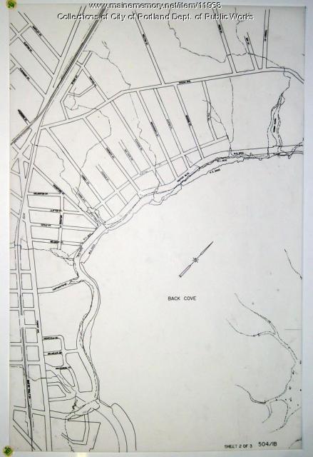
Filling in Back Cove, Portland, part 2, 1837-2003
Contributed by: City of Portland Dept. of Public Works Date: 1837–2003 Location: Portland Media: Ink on paper
Item 59770
Portland, South Portland, & Cape Elizabeth electric railroads, ca. 1941
Contributed by: Seashore Trolley Museum Date: circa 1941 Location: Portland Media: Ink on paper
Item 59772
Electric railroad route map, ca. 1933
Contributed by: Seashore Trolley Museum Date: circa 1933 Location: Portland; Falmouth; Yarmouth; Cumberland Media: Ink on paper
Item 104600
Map of the District of Maine, 1815
Contributed by: Osher Map Library and Smith Center for Cartographic Education Date: 1815 Media: Engraving
Item 104603
Map of the State of Maine, 1820
Contributed by: Osher Map Library and Smith Center for Cartographic Education Date: 1820 Media: Engraving
Item 104604
New Map of English America, 1677
Contributed by: Osher Map Library and Smith Center for Cartographic Education Date: 1777 Media: Engraving
Item 104782
Contributed by: Osher Map Library and Smith Center for Cartographic Education Date: 1793 Media: Engraving
Item 104783
Contributed by: Osher Map Library and Smith Center for Cartographic Education Date: 1794 Media: Engraving
Item 11854
Moses Greenleaf's Map of the inhabited part of the state of Maine, 1829
Contributed by: Maine Historical Society Date: 1778 Media: Ink wash on lithograph, Map
Item 23348
Map showing approaches to Mount Desert, 1903
Contributed by: Maine Historical Society Date: 1903 Media: Ink on paper, map
Item 16540
Map of the Rangeley Lake and Dead River regions, 1885
Contributed by: Maine Historical Society Date: 1885 Media: Ink on paper
Item 109022
Disputed lot E, Brunswick, 1811
Contributed by: Maine Historical Society
Date: 1811-09-03
Location: Brunswick
Media: Ink on paper
This record contains 3 images.
Item 148723
Timber map of Burbank Township, 1910-1911
Contributed by: Maine Historical Society Date: 1910–1911 Location: Burbank Media: Ink on paper
Item 176
Plan of Portland, engraved as a directory, 1852
Contributed by: Maine Historical Society Date: 1852 Location: Portland Media: Ink on paper
Item 12178
Moses Greenleaf vertical sections, 1829
Contributed by: Maine Historical Society Date: 1829 Media: Ink on paper
Item 148730
Copy of H.S. Ferguson plan for storage dam on Brassua Lake, 1924
Contributed by: Maine Historical Society Date: 1924 Location: Brassua Media: Ink on linen
Item 148977
Map of Dead River Plantation, ca. 1915
Contributed by: Maine Historical Society Date: circa 1915 Location: Dead River Plantation Media: Ink on linen
Item 148978
Map of Township 3 Range 9, ca. 1915
Contributed by: Maine Historical Society Date: circa 1915 Location: T3 R9 WELS Media: Ink on linen; hand coloring
Item 148979
Map of Township 8, Range 11, ca. 1915
Contributed by: Maine Historical Society Date: circa 1915 Location: T8 R11 WELS Media: Ink on linen
Item 148980
Map of Township 10 Range 8, ca. 1915
Contributed by: Maine Historical Society Date: circa 1915 Location: T10 R8 Media: Ink on linen


