Keywords: Border
- Historical Items (747)
- Tax Records (0)
- Architecture & Landscape (6)
- Online Exhibits (43)
- Site Pages (85)
- My Maine Stories (14)
- Lesson Plans (1)
Historical Items
These results include photographs, documents, letters, paintings, artifacts, and many other kinds of Maine related items from collections around the state and elsewhere.
Item 116521
Contributed by: Maine Historical Society Date: circa 1820 Media: Ink on paper
Item 116534
St. John River boundary survey, Five Islands, 1843
Contributed by: Maine Historical Society Date: 1843 Media: Ink on paper
Item 110900
Map detail for portions of Cornwall and Bug Islands, ca. 1820
Contributed by: Maine Historical Society
Date: circa 1820
Location: Cornwall Island ; St. Regis Island
Media: Graphite on paper
This record contains 3 images.
Item 110895
Plan of the islands at the mouth of the River St. Clair, ca. 1823
Contributed by: Maine Historical Society
Date: circa 1823
Media: Ink on paper
This record contains 3 images.
Item 116547
Northeastern Boundary of Minnesota, ca. 1820
Contributed by: Maine Historical Society Date: circa 1820 Media: Ink on paper
Item 116537
St. John River boundary survey no. 2, 1843
Contributed by: Maine Historical Society Date: 1843 Media: Ink on paper
Item 116538
St. John River boundary survey, No. 1, 1844
Contributed by: Maine Historical Society Date: 1844 Media: Ink on paper
Item 111022
A plane chart of Rainy Lake, ca. 1820
Contributed by: Maine Historical Society
Date: circa 1820
Media: Ink on paper
This record contains 5 images.
Item 111027
Manuscript map of the Lake of the Woods, ca. 1820
Contributed by: Maine Historical Society
Date: circa 1820
Media: Ink on paper
This record contains 9 images.
Item 110909
Map of the Northern part of the state of Maine and of the adjacent British Provinces, 1830
Contributed by: Maine Historical Society
Date: 1830
Media: Ink on paper
This record contains 2 images.
Item 104222
Fort Sullivan powder house remains, Eastport, 2018
Contributed by: Maine Historical Society Date: 2018 Location: Eastport Media: Digital photograph
Item 148646
Blockhouse, Fort Kent, ca. 1979
Contributed by: Acadian Archives Date: circa 1979 Location: Fort Kent Media: Photographic postcard
Item 148665
Bridge Street, Limestone, ca. 1910
Contributed by: Acadian Archives Date: circa 1910 Location: Limestone Media: Photographic postcard
Item 149689
County Map of the State of Maine, 1860
Contributed by: Acadian Archives Date: 1860 Media: Ink on paper
Item 110949
Boundary survey between New Brunswick and Maine, 1842
Contributed by: Maine Historical Society
Date: 1842
Media: Ink on paper
This record contains 8 images.
Item 20806
Contributed by: St. Croix Historical Society Date: 1936 Location: Jackman Media: Postcard
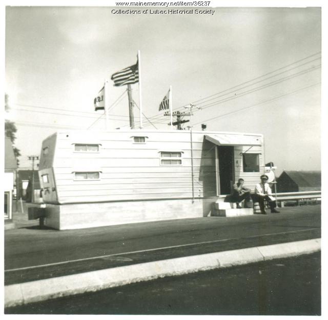
Item 36237
Customs office, Lubec, 1963, 1963
Contributed by: Lubec Historical Society Date: 1963 Location: Lubec Media: Photographic print
Item 105314
Panoramic view of the city of Calais, St. Stephen and Milltown, New Brunswick, 1879
Contributed by: Osher Map Library and Smith Center for Cartographic Education Date: 1879 Location: Calais; St. Stephen; Milltown Media: Lithograph
Item 148618
St. John River, Fort Kent, ca. 1979
Contributed by: Acadian Archives Date: 1979 Location: Fort Kent; Clair Media: Postcard
Item 148644
Madawaska as seen from Edmundston, New Brunswick, ca. 1975
Contributed by: Acadian Archives Date: circa 1975 Location: Madawaska; Edmundston Media: Photographic postcard
Item 148666
Fraser mill and international bridge, Madawaska, ca. 1940
Contributed by: Acadian Archives Date: circa 1940 Location: Madawaska; Edmundston Media: Photographic postcard
Item 149054
St. John River near Grand Isle, ca. 1973
Contributed by: Acadian Archives Date: circa 1973 Location: Grand Isle; Sainte-Anne Media: Photographic postcard
Item 149686
Contributed by: Acadian Archives Date: circa 1835 Media: Ink on paper
Item 149687
Contributed by: Acadian Archives Date: circa 1831 Media: Ink on paper


