Keywords: Maine--Maps, Manuscript
- Historical Items (117)
- Tax Records (0)
- Architecture & Landscape (0)
- Online Exhibits (4)
- Site Pages (87)
- My Maine Stories (0)
- Lesson Plans (0)
Historical Items
These results include photographs, documents, letters, paintings, artifacts, and many other kinds of Maine related items from collections around the state and elsewhere.
Item 11754
Plan for towns along the Androscoggin River, ca. 1760
Contributed by: Maine Historical Society Date: circa 1760 Location: Livermore Falls; Canton; Mexico; Jay; Leeds Media: Ink on paper
Item 108768
Survey of lot no. 90, Durham, ca. 1790
Contributed by: Maine Historical Society Date: circa 1790 Location: Durham Media: Ink on paper
Item 135901
Description of Pagan and Chipman’s Meetings with Francis Joseph Neptune, 1796
Contributed by: Maine Historical Society
Date: 1796
Location: St. Andrews
Media: Ink on Paper
This record contains 8 images.
Item 5343
Contributed by: Maine Historical Society Date: 1743 Location: Harpswell Media: Ink on paper
Item 11733
Noyes, Skinner, and Merrill lots, Topsham, 1762
Contributed by: Maine Historical Society Date: 1762-01-05 Location: Topsham Media: Ink on paper
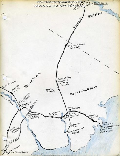
Item 59765
Kennebunk Village to Cape Porpoise electric railroads, ca. 1927
Contributed by: Seashore Trolley Museum Date: circa 1927 Location: Kennebunk; Cape Porpoise Media: Ink on paper
Item 104602
A plan of the District of Maine, 1795
Contributed by: Osher Map Library and Smith Center for Cartographic Education Date: 1795 Media: Ink on Paper
Item 10537
Contributed by: Maine Historical Society Date: 1717 Location: Brunswick Media: Ink on paper
Item 12396
Androscoggin River area map, 1771
Contributed by: Maine Historical Society
Date: 1771-06-11
Location: Jay; Canton; Livermore Falls
Media: Ink on paper
This record contains 2 images.
Item 11718
Contributed by: Maine Historical Society Date: circa 1740 Location: Brunswick Media: Ink on paper
Item 11724
Map of Brunswick near the Narrows, 1737
Contributed by: Maine Historical Society
Date: 1737
Location: Brunswick; Topsham
Media: Ink on paper
This record contains 2 images.
Item 5960
Fort land for William Ross, Brunswick, ca. 1763
Contributed by: Maine Historical Society Date: circa 1763 Location: Brunswick Media: Ink on paper
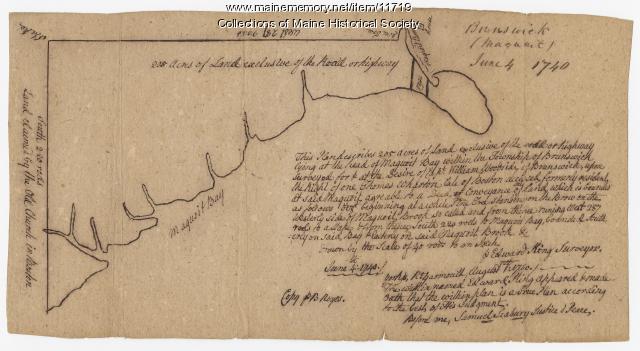
Item 11719
Contributed by: Maine Historical Society Date: 1740-06-04 Location: Brunswick Media: Ink on paper
Item 11720
Contributed by: Maine Historical Society Date: 1740-09-29 Location: Brunswick Media: Ink on paper
Item 11723
Contributed by: Maine Historical Society Date: 1747-07-06 Location: Brunswick Media: Ink on paper
Item 11726
Contributed by: Maine Historical Society
Date: 1795-05-29
Location: Brunswick; Durham; Freeport; Bath
Media: Ink on paper
This record contains 2 images.
Item 11728
Plan of a road in Brunswick, 1764
Contributed by: Maine Historical Society Date: 1764 Location: Brunswick; Bath Media: Ink on paper
Item 108766
Plan of lot no. 1, Lewiston, ca. 1800
Contributed by: Maine Historical Society Date: circa 1800 Location: Lewiston Media: Ink on paper
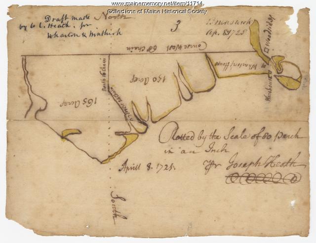
Item 11714
Contributed by: Maine Historical Society Date: 1725-04-08 Location: Brunswick Media: Ink on paper
Item 110355
Survey of lots, Georgetown, 1793
Contributed by: Maine Historical Society Date: circa 1780 Location: Lubec Media: Ink on paper
Item 11721
Plan of Land at Brunswick Narrows, 1741
Contributed by: Maine Historical Society Date: 1741 Location: Brunswick Media: Ink on paper
Item 11722
Map of Brunswick, lots on Merrymeeting Bay, ca. 1750
Contributed by: Maine Historical Society
Date: circa 1750
Location: Brunswick
Media: Ink on paper
This record contains 2 images.
Item 11725
Contributed by: Maine Historical Society Date: 1772 Location: Brunswick Media: Ink on paper
Item 59770
Portland, South Portland, & Cape Elizabeth electric railroads, ca. 1941
Contributed by: Seashore Trolley Museum Date: circa 1941 Location: Portland Media: Ink on paper


