Keywords: Manuscript
- Historical Items (1125)
- Tax Records (0)
- Architecture & Landscape (0)
- Online Exhibits (22)
- Site Pages (75)
- My Maine Stories (0)
- Lesson Plans (1)
Historical Items
These results include photographs, documents, letters, paintings, artifacts, and many other kinds of Maine related items from collections around the state and elsewhere.
Item 1492

Washington County votes on separation from Massachusetts, 1816
Contributed by: Maine Historical Society Date: 1816 Media: Ink on paper
Item 12572

Contributed by: Maine Historical Society Date: 1731 Location: Brunswick; Phippsburg Media: Ink on paper
Item 4318

Androscoggin River above Lewiston, ca. 1750
Contributed by: Maine Historical Society Date: circa 1750 Location: Turner; Livermore; Wayne; Leeds Media: Ink on paper
Item 116500

Sketch of Drummond Island and straight between Lake Huron and Superior, ca. 1820
Contributed by: Maine Historical Society Date: circa 1820 Location: Sault St. Marie; Sault Ste. Marie Media: Ink on paper
Item 116514

St. John River boundary survey, Little Black River rapids, ca. 1843
Contributed by: Maine Historical Society Date: circa 1843 Media: Ink on paper
Item 11743

Contributed by: Maine Historical Society Date: 1742-11-12 Location: Harpswell Media: Ink on paper
Item 12627

Merryconeag and Maquoit marshes, ca. 1730
Contributed by: Maine Historical Society Date: circa 1730 Location: Brunswick Media: Ink on paper
Item 12630

Upper end of Long Reach, Bath, 1728
Contributed by: Maine Historical Society Date: 1728-11-18 Location: Bath Media: Ink on paper
Item 12940

Map of lots G1 and G2 for James Pitts, near Clinton, 1769
Contributed by: Maine Historical Society Date: 1769-11-07 Location: Skowhegan Media: Ink on paper
Item 110898

St. Regis Village at the river St. Lawrence, New York, ca. 1815
Contributed by: Maine Historical Society Date: circa 1815 Location: Waverly Media: Ink on paper
Item 11989

Plan of Ann (now Park) Street, Portland, ca. 1802
Contributed by: Maine Historical Society Date: circa 1802 Location: Portland Media: Pen, Ink and watercolor on paper, map
Item 116487

Canaan Corner, Northeast Boundary, ca. 1820
Contributed by: Maine Historical Society Date: circa 1820 Location: Canaan Media: Ink on paper
Item 12411

Samuel and Hugh Wilson survey, 1767
Contributed by: Maine Historical Society Date: 1767 Location: Brunswick Media: Ink on paper
Item 110988

Contributed by: Maine Historical Society Date: circa 1820 Media: Ink on paper
Item 11746

Contributed by: Maine Historical Society Date: 1749-07-04 Location: Brunswick; Harpswell Media: Ink on paper
Item 12626

Mereconege Neck, Harpswell, ca. 1780
Contributed by: Maine Historical Society Date: circa 1760 Location: Harpswell Media: Ink on paper
Item 12631

Five farm lots, Bowdoinham, 1718
Contributed by: Maine Historical Society Date: 1718 Location: Bowdoinham Media: Ink on paper
Item 116493

Crooked Lake and Lake Namacan, ca. 1820
Contributed by: Maine Historical Society Date: circa 1820 Media: Ink on paper
Item 6849

Contributed by: Maine Historical Society Date: 1794 Location: Augusta; Hallowell Media: Ink on paper
Item 11751

North Yarmouth road, Yarmouth, ca. 1760
Contributed by: Maine Historical Society Date: circa 1760 Location: Yarmouth Media: Ink on paper
Item 11974

John Merrill lot, Topsham, 1762
Contributed by: Maine Historical Society Date: 1762 Location: Topsham Media: Ink on paper
Item 11729

Land surveyed for Hugh Wilson, Topsham, 1761
Contributed by: Maine Historical Society Date: 1761-01-01 Location: Topsham Media: Ink on paper
Item 11732

Contributed by: Maine Historical Society Date: circa 1760 Location: Topsham Media: Ink on paper
Item 12197
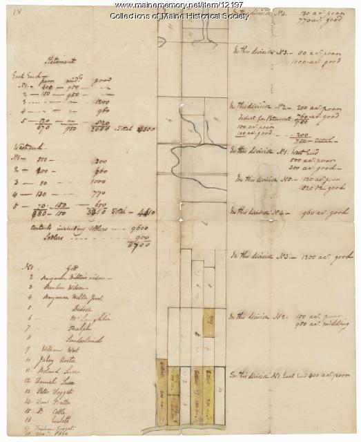
Division of the Tyng and Lowell estates, ca. 1760
Contributed by: Maine Historical Society Date: circa 1760 Media: Ink on paper
