Keywords: Manuscript map
- Historical Items (364)
- Tax Records (0)
- Architecture & Landscape (0)
- Online Exhibits (9)
- Site Pages (96)
- My Maine Stories (0)
- Lesson Plans (0)
Historical Items
These results include photographs, documents, letters, paintings, artifacts, and many other kinds of Maine related items from collections around the state and elsewhere.
Item 12395
Map of Wesserunsett stream, 1790
Contributed by: Maine Historical Society
Date: 1790-12-12
Location: Canaan
Media: Ink on paper
This record contains 2 images.
Item 110981
Contributed by: Maine Historical Society
Date: 1817–1820
Media: Ink on paper
This record contains 7 images.
Item 12399
Map of Draper's Claim, near Bath, 1795
Contributed by: Maine Historical Society
Date: 1795
Media: Ink on paper
This record contains 2 images.
Item 109000
Dresden and Woolwich proposed border, ca. 1757
Contributed by: Maine Historical Society Date: circa 1757 Location: Woolwich; Dresden Media: Ink on paper
Item 58322
Copy of early Surry map, ca. 1880
Contributed by: Maine Historical Society Date: circa 1880 Location: Surry Media: Ink on paper
Item 110976
Manuscript survey of Indian Stream, New Hampshire, 1843-1844
Contributed by: Maine Historical Society
Date: 1843–1844
Location: Pittsburg
Media: Ink on paper
This record contains 5 images.
Item 21566
Contributed by: Maine Historical Society Date: 1687 Location: North Yarmouth Media: Ink on paper
Item 110963
Map of Lake St. Lawrence, 1820
Contributed by: Maine Historical Society
Date: 1814
Media: Ink on paper
This record contains 4 images.
Item 108848
Map and petition, Sandy River, 1798
Contributed by: Maine Historical Society
Date: 1798
Location: New Vineyard; Farmington
Media: Ink on paper
This record contains 2 images.
Item 110967
Map of Islands on Lake Huron, ca. 1820
Contributed by: Maine Historical Society
Date: circa 1820
Location: Drummond
Media: Ink on paper
This record contains 9 images.
Item 7490
Nova Belgica et Anglia Nova, ca. 1635
Contributed by: Maine Historical Society Date: circa 1635 Media: Map, ink on paper
Item 108853
A plan of a survey of sundry settlers' lots in Sheepscut Great Pond Settlement, 1802
Contributed by: Maine Historical Society
Date: circa 1802
Location: Palermo
Media: ink on paper
This record contains 2 images.
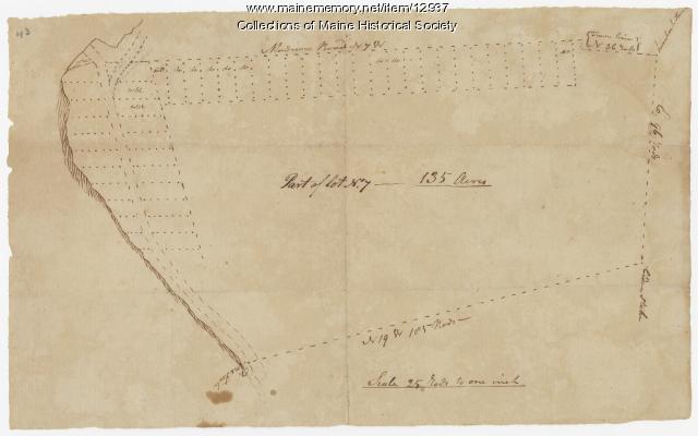
Item 12937
Map of lot no. 7, 135 acres on Madison Road, Skowhegan, ca. 1760
Contributed by: Maine Historical Society
Date: circa 1760
Location: Skowhegan
Media: Ink on paper
This record contains 2 images.
Item 12940
Map of lots G1 and G2 for James Pitts, near Clinton, 1769
Contributed by: Maine Historical Society
Date: 1769-11-07
Location: Skowhegan
Media: Ink on paper
This record contains 3 images.
Item 104782
Contributed by: Osher Map Library and Smith Center for Cartographic Education Date: 1793 Media: Engraving
Item 11722
Map of Brunswick, lots on Merrymeeting Bay, ca. 1750
Contributed by: Maine Historical Society
Date: circa 1750
Location: Brunswick
Media: Ink on paper
This record contains 2 images.
Item 12560
Plan of lots on Sheepscot Pond, Palermo, 1806
Contributed by: Maine Historical Society
Date: 1806-06-27
Location: Palermo
Media: Ink on paper
This record contains 2 images.
Item 108862
Survey of lots for Peter Brown, Georgetown, 1761
Contributed by: Maine Historical Society Date: 1761-01-12 Location: Bath Media: Ink on paper
Item 102072
Plan of Royalsborough, ca. 1766
Contributed by: Maine Historical Society Date: circa 1766 Location: Durham Media: Ink on vellum
Item 116519
Map of Maine with northeast boundary lines, ca. 1850
Contributed by: Maine Historical Society Date: circa 1850 Media: Ink on paper
Item 11924
Lots on Maquoit Road, Brunswick, 1761
Contributed by: Maine Historical Society Date: 1761 Location: Brunswick Media: Ink on paper
Item 6665
Pascatway River in New England, ca. 1890
Contributed by: Maine State Archives Date: circa 1670 Media: Paper
Item 108858
Plan of 200 acres on the Western Side of Kennebec River, Frankfort Plantation, 1758
Contributed by: Maine Historical Society
Date: 1758
Location: Dresden
Media: Ink on paper
This record contains 2 images.
Item 116488
A New Map of the Province of Lower Canada, 1838
Contributed by: Maine Historical Society
Date: 1838
Media: Ink on paper
This record contains 2 images.


