LC Subject Heading: Lakes
- Historical Items (837)
- Tax Records (0)
- Architecture & Landscape (3)
- Online Exhibits (0)
- Site Pages (0)
- My Maine Stories (0)
- Lesson Plans (0)
Historical Items
These results include photographs, documents, letters, paintings, artifacts, and many other kinds of Maine related items from collections around the state and elsewhere.
Item 111036
Contributed by: Maine Historical Society
Date: circa 1820
Media: Ink on paper
This record contains 7 images.
Item 116498
Manuscript survey of Lac La Croci, Vermillion Lake, ca. 1820
Contributed by: Maine Historical Society
Date: circa 1820
Media: Ink on paper
This record contains 2 images.
Item 116504
Manuscript Map of Lake Ontario, 1819
Contributed by: Maine Historical Society Date: 1819 Media: Ink on paper
Item 116523
Manuscript map of Cape Hurd, Lake Huron, ca. 1820
Contributed by: Maine Historical Society
Date: circa 1820
Media: Ink on paper
This record contains 2 images.
Item 116547
Northeastern Boundary of Minnesota, ca. 1820
Contributed by: Maine Historical Society Date: circa 1820 Media: Ink on paper
Item 148723
Timber map of Burbank Township, 1910-1911
Contributed by: Maine Historical Society Date: 1910–1911 Location: Burbank Media: Ink on paper
Item 4318
Androscoggin River above Lewiston, ca. 1750
Contributed by: Maine Historical Society Date: circa 1750 Location: Turner; Livermore; Wayne; Leeds Media: Ink on paper
Item 110889
Sketch of the Strait of Detroit from Lake Erie to Lake St. Clair, ca. 1823
Contributed by: Maine Historical Society
Media: Ink on paper
This record contains 3 images.
Item 11304
Kidney Pond Camps sign, Baxter State Park, ca. 1960
Contributed by: Baxter State Park Date: circa 1960 Location: T3 R10 WELS Media: Photographic print
Item 12855
Plan of Cumberland and Lincoln counties, 1773
Contributed by: Maine Historical Society
Date: 1773
Media: Ink on paper
This record contains 2 images.
Item 23414
Indian encampment, Portland, 1920
Contributed by: Maine Historical Society/MaineToday Media Date: 1920 Location: Portland Media: Glass Negative
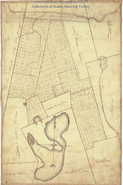
Item 35621
Contributed by: Maine Historical Society Date: circa 1792 Location: Stoneham; Lovell; Bethel; Albany; Mason Twp.; Bachelders Grant Media: Ink on fabric
Item 110934
Sketch of Lake St. Clair, Michigan, and Ontario, ca. 1820
Contributed by: Maine Historical Society
Date: circa 1820
Media: Ink on paper
This record contains 2 images.
Item 110957
Manuscript map of Lake Erie, ca. 1818
Contributed by: Maine Historical Society Date: circa 1818 Media: Ink on paper
Item 110958
Manuscript map of Lake Ontario, ca. 1820
Contributed by: Maine Historical Society
Date: circa 1815
Media: Ink on paper
This record contains 5 images.
Item 110963
Map of Lake St. Lawrence, 1820
Contributed by: Maine Historical Society
Date: 1814
Media: Ink on paper
This record contains 4 images.
Item 110967
Map of Islands on Lake Huron, ca. 1820
Contributed by: Maine Historical Society
Date: circa 1820
Location: Drummond
Media: Ink on paper
This record contains 9 images.
Item 110993
Pigeon River, waterways between Lakes Kaseigunaha and Superior, ca. 1820
Contributed by: Maine Historical Society
Date: circa 1820
Media: Ink on paper
This record contains 4 images.
Item 111004
Mouth of Detroit River, ca. 1820
Contributed by: Maine Historical Society
Date: circa 1820
Media: Ink on paper
This record contains 4 images.
Item 111008
Pigeon River, including waterways between Lakes Kaseigunaha and Superior, ca. 1820
Contributed by: Maine Historical Society
Date: circa 1820
Media: Ink on paper
This record contains 4 images.
Item 111043
Northern boundary of Michigan, ca. 1820
Contributed by: Maine Historical Society
Date: circa 1820
Media: Ink on paper
This record contains 5 images.
Item 111049
Survey of Muddy Lake, ca. 1822
Contributed by: Maine Historical Society
Date: circa 1822
Media: Ink on paper
This record contains 20 images.
Item 116500
Sketch of Drummond Island and straight between Lake Huron and Superior, ca. 1820
Contributed by: Maine Historical Society
Date: circa 1820
Location: Sault St. Marie; Sault Ste. Marie
Media: Ink on paper
This record contains 2 images.
Item 116503
Manuscript map of Lake St. Clair, 1820
Contributed by: Maine Historical Society Date: 1820 Media: Ink on paper


