Keywords: Northeast boundary
- Historical Items (308)
- Tax Records (0)
- Architecture & Landscape (2)
- Online Exhibits (9)
- Site Pages (223)
- My Maine Stories (0)
- Lesson Plans (0)
Historical Items
These results include photographs, documents, letters, paintings, artifacts, and many other kinds of Maine related items from collections around the state and elsewhere.
Item 15010

Co-cum-go-muc Mountains, ca. 1841
Contributed by: Maine Historical Society Date: circa 1841 Media: Transparency
Item 17397

Junction of the Du Loup River with the Chaudiere River, ca. 1841
Contributed by: Maine Historical Society Date: circa 1841 Media: Transparency
Item 17398

Sketch of country toward the St. John River, ca. 1841
Contributed by: Maine Historical Society Date: circa 1841 Media: Transparency
Item 17400

Contributed by: Maine Historical Society Date: 1841-10-20 Media: Transparency
Item 17402

Contributed by: Maine Historical Society Date: 1841 Media: Transparency
Item 17399

Otter Pond, Du Loup Water, 1841
Contributed by: Maine Historical Society Date: 1841-09-20 Media: Transparency
Item 11823

Champlain map copy, Saint Croix or Bone Island, ca. 1799
Contributed by: Maine Historical Society Date: circa 1613 Media: Ink on paper
Item 12178

Moses Greenleaf vertical sections, 1829
Contributed by: Maine Historical Society Date: 1829 Media: Ink on paper
Item 110893

Extract from a map of the British and French Dominions in North America, ca. 1845
Contributed by: Maine Historical Society
Date: circa 1755
Media: ink on paper
This record contains 2 images.
Item 110895

Plan of the islands at the mouth of the River St. Clair, ca. 1823
Contributed by: Maine Historical Society
Date: circa 1823
Media: Ink on paper
This record contains 3 images.
Item 100203

Alexander Wadsworth Longfellow, Portland, ca. 1855
Contributed by: NPS, Longfellow House-Washington's Headquarters National Historic Site Date: circa 1855 Location: Portland Media: Daguerreotype
Item 110917

Bowen & Co. United States and British possessions map, British Columbia, 1846
Contributed by: Maine Historical Society
Date: circa 1846
Location: Orcas Island; Vancouver Island
Media: Ink on paper
This record contains 17 images.
Item 110905

Map of "Islands by Treaty of 1783," ca. 1817
Contributed by: Maine Historical Society
Date: 1783
Media: Ink on paper
This record contains 2 images.
Item 11656

Maps of the Tuladie and Green Rivers, 1820
Contributed by: Maine Historical Society Date: 1820 Media: Ink on paper
Item 11827
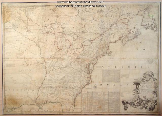
Map of the British and French North America, 1775
Contributed by: Maine Historical Society Date: 1755 Media: Ink on paper, map
Item 110889

Sketch of the Strait of Detroit from Lake Erie to Lake St. Clair, ca. 1823
Contributed by: Maine Historical Society
Media: Ink on paper
This record contains 3 images.
Item 6415

Pulpit Rock near Lewis Cove, Perry, 1836
Contributed by: Maine Historical Society Date: 1836-08-10 Location: Perry Media: Ink on paper
Item 9598

Plan of the British and American positions, Aroostook War, 1843
Contributed by: Maine State Museum Date: 1843 Media: Ink on paper
Item 110913

"Part of Bug Island" map fragment, ca. 1823
Contributed by: Maine Historical Society
Date: circa 1823
Media: Ink on paper
This record contains 2 images.
Item 11828

Exploring survey, St. Croix River to Great Waggansis, 1817
Contributed by: Maine Historical Society Date: 1817 Media: Ink on paper
Item 116537

St. John River boundary survey no. 2, 1843
Contributed by: Maine Historical Society Date: 1843 Media: Ink on paper
Item 148644

Madawaska as seen from Edmundston, New Brunswick, ca. 1975
Contributed by: Acadian Archives Date: circa 1975 Location: Madawaska; Edmundston Media: Photographic postcard
Item 135915

Documents relating to the history of the Eastern Boundary, 1826
Contributed by: Maine Historical Society
Date: 1821
Location: St. Andrews
Media: Ink on Paper
This record contains 107 images.
Item 111027

Manuscript map of the Lake of the Woods, ca. 1820
Contributed by: Maine Historical Society
Date: circa 1820
Media: Ink on paper
This record contains 9 images.
