Keywords: land survey
- Historical Items (121)
- Tax Records (0)
- Architecture & Landscape (127)
- Online Exhibits (22)
- Site Pages (114)
- My Maine Stories (2)
- Lesson Plans (0)
Historical Items
These results include photographs, documents, letters, paintings, artifacts, and many other kinds of Maine related items from collections around the state and elsewhere.
Item 11733
Noyes, Skinner, and Merrill lots, Topsham, 1762
Contributed by: Maine Historical Society Date: 1762-01-05 Location: Topsham Media: Ink on paper
Item 5343
Contributed by: Maine Historical Society Date: 1743 Location: Harpswell Media: Ink on paper
Item 9221
Copy of a letter on backlots near Kennebec River, 1774
Contributed by: Maine Historical Society Date: 1774 Media: Ink on paper
Item 14610
Surveyor's compass, Fort Kent, ca. 1890
Contributed by: Fort Kent Historical Society Date: circa 1890 Location: Fort Kent Media: Metal, glass
Item 112084
Pejepscot Company Records, Volume 1B, 1741-1814
Contributed by: Maine Historical Society
Date: 1741–1814
Location: Brunswick; Georgetown; Topsham
Media: Ink on paper
This record contains 33 images.
Item 11715
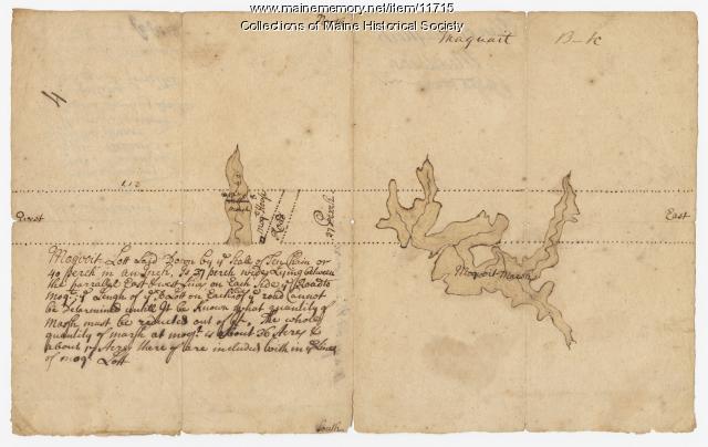
Plan of Maquoit Meadows, ca. 1720
Contributed by: Maine Historical Society Date: circa 1720 Location: Brunswick Media: Ink on paper
Item 11741
Contributed by: Maine Historical Society Date: 1742 Location: Harpswell Media: Ink on paper
Item 11743
Contributed by: Maine Historical Society Date: 1742-11-12 Location: Harpswell Media: Ink on paper
Item 110867
"Plan of a tract of land lying 15 English miles on each side of Kennebeck River," 1751
Contributed by: Maine Historical Society
Date: 1751
Media: Ink on paper
This record contains 10 images.
Item 10537
Contributed by: Maine Historical Society Date: 1717 Location: Brunswick Media: Ink on paper
Item 37702
Contributed by: Maine Historical Society Date: 1764-09-15 Media: Ink on paper
Item 108858
Plan of 200 acres on the Western Side of Kennebec River, Frankfort Plantation, 1758
Contributed by: Maine Historical Society
Date: 1758
Location: Dresden
Media: Ink on paper
This record contains 2 images.
Item 31237
Moses Banks Map, Scarborough, 1787
Contributed by: Scarborough Historical Society & Museum Date: 1787 Location: Scarborough Media: Paper and ink
Item 6885
Plan of James Deering's Farm, Portland, 1843
Contributed by: Maine Historical Society Date: 1843 Location: Portland Media: Ink on paper
Item 12938
Ten lots near Sebasticook River, ca. 1760
Contributed by: Maine Historical Society
Date: circa 1760
Location: China; Vassalboro
Media: Ink on paper
This record contains 2 images.
Item 12937
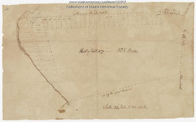
Map of lot no. 7, 135 acres on Madison Road, Skowhegan, ca. 1760
Contributed by: Maine Historical Society
Date: circa 1760
Location: Skowhegan
Media: Ink on paper
This record contains 2 images.
Item 12399
Map of Draper's Claim, near Bath, 1795
Contributed by: Maine Historical Society
Date: 1795
Media: Ink on paper
This record contains 2 images.
Item 11773
Surveyor's half chain, ca. 1800
Contributed by: Maine Historical Society Date: circa 1800 Media: Iron, brass
Item 12126
Kennebec and Sagadahoc Rivers, 1755
Contributed by: Maine Historical Society
Date: 1754
Media: Ink on paper
This record contains 2 images.
Item 148977
Map of Dead River Plantation, ca. 1915
Contributed by: Maine Historical Society Date: circa 1915 Location: Dead River Plantation Media: Ink on linen
Item 116487
Canaan Corner, Northeast Boundary, ca. 1820
Contributed by: Maine Historical Society Date: circa 1820 Location: Canaan Media: Ink on paper
Item 9259
Early map of the Salmon Falls River in Lebanon, 1766
Contributed by: Maine Historical Society Date: 1766 Location: Lebanon Media: Ink on paper
Item 11772
Surveyor's Vernier Compass, ca. 1840
Contributed by: Maine Historical Society Date: circa 1840 Media: Brass, glass and pine
Item 54904
Schooner 'Bowdoin' in winter quarters, Baffin Island, 1922
Contributed by: Peary-MacMillan Arctic Museum and Arctic Studies Center Date: 1922-04-02 Location: Bowdoin Harbor Media: Photographic print


