LC Subject Heading: Northeast Boundary of the United States
- Historical Items (170)
- Tax Records (0)
- Architecture & Landscape (0)
- Online Exhibits (0)
- Site Pages (0)
- My Maine Stories (0)
- Lesson Plans (0)
Historical Items
These results include photographs, documents, letters, paintings, artifacts, and many other kinds of Maine related items from collections around the state and elsewhere.
Item 11827
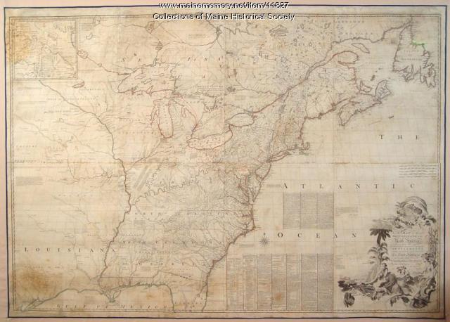
Map of the British and French North America, 1775
Contributed by: Maine Historical Society Date: 1755 Media: Ink on paper, map
Item 15010

Co-cum-go-muc Mountains, ca. 1841
Contributed by: Maine Historical Society Date: circa 1841 Media: Transparency
Item 17397

Junction of the Du Loup River with the Chaudiere River, ca. 1841
Contributed by: Maine Historical Society Date: circa 1841 Media: Transparency
Item 17398

Sketch of country toward the St. John River, ca. 1841
Contributed by: Maine Historical Society Date: circa 1841 Media: Transparency
Item 17399

Otter Pond, Du Loup Water, 1841
Contributed by: Maine Historical Society Date: 1841-09-20 Media: Transparency
Item 17400

Contributed by: Maine Historical Society Date: 1841-10-20 Media: Transparency
Item 17401

Falls of the Du Loup, ca. 1841
Contributed by: Maine Historical Society Date: circa 1841 Media: Transparency
Item 17402

Contributed by: Maine Historical Society Date: 1841 Media: Transparency
Item 20763

Penobscot River and Chesuncook Lake, 1820
Contributed by: Maine Historical Society Date: 1820 Media: Ink on paper
Item 20814

Jarvis letter concerning Maine boundaries, 1832
Contributed by: Maine Historical Society Date: 1832 Media: Ink on paper
Item 26720

Colonel John Allan's cenotaph, Treat's Island, 1970
Contributed by: Lubec Memorial Library Date: 1970 Location: Eastport Media: Photographic print
Item 28346

Horatio Bridge to G.W. Pierce on political issues, 1832
Contributed by: Maine Historical Society Date: 1832 Location: Portland; Augusta Media: Ink on paper
Item 28423

John Quincy Adams instruction on northeast boundary, 1823
Contributed by: Maine Historical Society Date: 1823 Media: Ink on paper
Item 31460

Contributed by: Penobscot Marine Museum Date: 1911 Location: Fort Kent Media: Glass Negative
Item 36261

Ebeneezer Greely letter from jail, New Brunswick, 1837
Contributed by: Maine Historical Society Date: 1837 Location: Madawaska; Fredericton Media: Ink on paper
Item 110898

St. Regis Village at the river St. Lawrence, New York, ca. 1815
Contributed by: Maine Historical Society Date: circa 1815 Location: Waverly Media: Ink on paper
Item 110905

Map of "Islands by Treaty of 1783," ca. 1817
Contributed by: Maine Historical Society Date: 1783 Media: Ink on paper
Item 110911

North Branch of the Meduxnekeag River, ca. 1817
Contributed by: Maine Historical Society Date: circa 1817 Media: Ink on paper
Item 110913

"Part of Bug Island" map fragment, ca. 1823
Contributed by: Maine Historical Society Date: circa 1823 Media: Ink on paper
Item 110936

Map of Campobello Island, ca. 1840
Contributed by: Maine Historical Society Date: circa 1840 Location: Campobello Island Media: Ink on paper
Item 110988

Contributed by: Maine Historical Society Date: circa 1820 Media: Ink on paper
Item 111019

A plane chart of Koochechee Seepe, called Rainy River, ca. 1820
Contributed by: Maine Historical Society Date: circa 1820 Media: Ink on paper
Item 111036

Contributed by: Maine Historical Society Date: circa 1820 Media: Ink on paper
Item 116491

Manuscript map of Lake Superior to Lake of the Woods, ca. 1822
Contributed by: Maine Historical Society Date: circa 1820 Media: Ink on paper
