Keywords: Maps, Manuscript.
- Historical Items (364)
- Tax Records (0)
- Architecture & Landscape (0)
- Online Exhibits (9)
- Site Pages (96)
- My Maine Stories (0)
- Lesson Plans (0)
Historical Items
These results include photographs, documents, letters, paintings, artifacts, and many other kinds of Maine related items from collections around the state and elsewhere.
Item 108765
Edward Little plan of lots, ca. 1820
Contributed by: Maine Historical Society Date: circa 1820 Media: Ink on paper
Item 116488
A New Map of the Province of Lower Canada, 1838
Contributed by: Maine Historical Society
Date: 1838
Media: Ink on paper
This record contains 2 images.
Item 108862
Survey of lots for Peter Brown, Georgetown, 1761
Contributed by: Maine Historical Society Date: 1761-01-12 Location: Bath Media: Ink on paper
Item 6849
Contributed by: Maine Historical Society Date: 1794 Location: Augusta; Hallowell Media: Ink on paper
Item 116514
St. John River boundary survey, Little Black River rapids, ca. 1843
Contributed by: Maine Historical Society Date: circa 1843 Media: Ink on paper
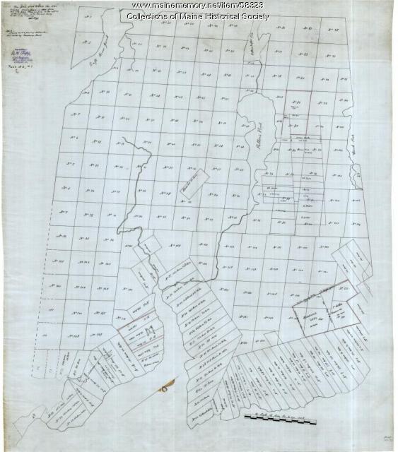
Item 58323
Copy of Surry and Ellsworth map, ca. 1880
Contributed by: Maine Historical Society Date: circa 1880 Location: Ellsworth; Surry Media: Ink on paper
Item 12939
Henry May, James Larking lot, near the Sheepscot River, 1805
Contributed by: Maine Historical Society
Date: 1805-11-25
Media: Ink on paper
This record contains 2 images.
Item 110889
Sketch of the Strait of Detroit from Lake Erie to Lake St. Clair, ca. 1823
Contributed by: Maine Historical Society
Media: Ink on paper
This record contains 3 images.
Item 116537
St. John River boundary survey no. 2, 1843
Contributed by: Maine Historical Society Date: 1843 Media: Ink on paper
Item 35622
Contributed by: Maine Historical Society Date: 1871 Location: Lovell Media: Ink on paper
Item 12560
Plan of lots on Sheepscot Pond, Palermo, 1806
Contributed by: Maine Historical Society
Date: 1806-06-27
Location: Palermo
Media: Ink on paper
This record contains 2 images.
Item 12399
Map of Draper's Claim, near Bath, 1795
Contributed by: Maine Historical Society
Date: 1795
Media: Ink on paper
This record contains 2 images.
Item 110913
"Part of Bug Island" map fragment, ca. 1823
Contributed by: Maine Historical Society
Date: circa 1823
Media: Ink on paper
This record contains 2 images.
Item 116540
Map of the boundary lines between the United States and the adjacent British provinces, 1843
Contributed by: Maine Historical Society Date: 1843 Media: Ink on paper
Item 12941
Plan of the Kennebec River, Nov. 1763
Contributed by: Maine Historical Society
Date: 1763
Location: Richmond
Media: Ink on paper
This record contains 2 images.
Item 5335
Brunswick and Topsham, ca. 1730
Contributed by: Maine Historical Society Date: circa 1730 Location: Brunswick; Topsham Media: Ink on paper
Item 12851
Contributed by: Maine Historical Society
Date: 1798
Media: Ink on paper
This record contains 2 images.
Item 20763
Penobscot River and Chesuncook Lake, 1820
Contributed by: Maine Historical Society Date: 1820 Media: Ink on paper
Item 6851
Chief Wasp map of Lake Vermillion, Sandy Point, ca. 1820
Contributed by: Maine Historical Society Date: circa 1825 Media: Graphite on paper
Item 11285
Map of the Conquest of Katahdin, 1933
Contributed by: Baxter State Park Date: 1934 Location: Mt. Katahdin Twp. Media: Ink on paper, Photographic print
Item 11928
Fulton and Patten lots in Bowdoinham, 1759
Contributed by: Maine Historical Society
Date: 1759
Location: Bowdoinham
Media: Ink on paper
This record contains 2 images.
Item 108767
Plan of land in Brunswick, ca. 1800
Contributed by: Maine Historical Society Date: circa 1800 Location: Brunswick Media: Ink on paper
Item 108768
Survey of lot no. 90, Durham, ca. 1790
Contributed by: Maine Historical Society Date: circa 1790 Location: Durham Media: Ink on paper
Item 108753
Plan of the Bracket Lots, Androscoggin County, ca. 1800
Contributed by: Maine Historical Society
Date: circa 1800
Location: Durham
Media: Ink on paper
This record contains 2 images.


