LC Subject Heading: Manuscripts
- Historical Items (895)
- Tax Records (0)
- Architecture & Landscape (0)
- Online Exhibits (0)
- Site Pages (0)
- My Maine Stories (0)
- Lesson Plans (0)
Historical Items
These results include photographs, documents, letters, paintings, artifacts, and many other kinds of Maine related items from collections around the state and elsewhere.
Item 7490

Nova Belgica et Anglia Nova, ca. 1635
Contributed by: Maine Historical Society Date: circa 1635 Media: Map, ink on paper
Item 7492

Novi Belgii: Novaeque Angliae Nec Non partis Virginiae, ca. 1655
Contributed by: Maine Historical Society Date: circa 1655 Media: Map, ink on paper
Item 7564

Resolution to send troops to Madawaska region, 1839
Contributed by: Maine Historical Society Date: 1839-01-23 Location: Augusta Media: Ink on paper
Item 7575

Lucia Wadsworth's Geometry and Geography School Book, 1794
Contributed by: Maine Historical Society
Date: 1794
Media: Ink on paper
This record contains 50 images.
Item 12888

Yarmouth, North Yarmouth and Freeport, 1727
Contributed by: Maine Historical Society Date: 1727-12-19 Location: Freeport; Yarmouth; North Yarmouth Media: Ink on paper
Item 33928

Survey plot, Cambridge Commons, 1792
Contributed by: Jonathan Fisher Memorial, Inc. Date: 1792 Location: Blue Hill Media: Ink on paper
Item 111022

A plane chart of Rainy Lake, ca. 1820
Contributed by: Maine Historical Society
Date: circa 1820
Media: Ink on paper
This record contains 5 images.
Item 111027

Manuscript map of the Lake of the Woods, ca. 1820
Contributed by: Maine Historical Society
Date: circa 1820
Media: Ink on paper
This record contains 9 images.
Item 116519

Map of Maine with northeast boundary lines, ca. 1850
Contributed by: Maine Historical Society Date: circa 1850 Media: Ink on paper
Item 11656

Maps of the Tuladie and Green Rivers, 1820
Contributed by: Maine Historical Society Date: 1820 Media: Ink on paper
Item 110900

Map detail for portions of Cornwall and Bug Islands, ca. 1820
Contributed by: Maine Historical Society
Date: circa 1820
Location: Cornwall Island ; St. Regis Island
Media: Graphite on paper
This record contains 3 images.
Item 110997

Map of the disputed portions of the New Brunswick and Lower Canada, 1839
Contributed by: Maine Historical Society
Date: 1839
Media: Ink on paper
This record contains 7 images.
Item 116537

St. John River boundary survey no. 2, 1843
Contributed by: Maine Historical Society Date: 1843 Media: Ink on paper
Item 12572

Contributed by: Maine Historical Society Date: 1731 Location: Brunswick; Phippsburg Media: Ink on paper
Item 11657

Map of the Mouth of the St. Francis River, 1843
Contributed by: Maine Historical Society Date: 1843 Media: Ink on paper
Item 11743

Contributed by: Maine Historical Society Date: 1742-11-12 Location: Harpswell Media: Ink on paper
Item 8561

Passamaquoddy Bay, Grand Manan map, 1817
Contributed by: Maine Historical Society Date: 1817 Media: Ink on paper
Item 11977

Plan of part of the Eastern Shore, 1753
Contributed by: Maine Historical Society
Date: 1753
Media: Ink on paper
This record contains 2 images.
Item 12626

Mereconege Neck, Harpswell, ca. 1780
Contributed by: Maine Historical Society Date: circa 1760 Location: Harpswell Media: Ink on paper
Item 12627

Merryconeag and Maquoit marshes, ca. 1730
Contributed by: Maine Historical Society Date: circa 1730 Location: Brunswick Media: Ink on paper
Item 12630

Upper end of Long Reach, Bath, 1728
Contributed by: Maine Historical Society Date: 1728-11-18 Location: Bath Media: Ink on paper
Item 12631

Five farm lots, Bowdoinham, 1718
Contributed by: Maine Historical Society Date: 1718 Location: Bowdoinham Media: Ink on paper
Item 12940

Map of lots G1 and G2 for James Pitts, near Clinton, 1769
Contributed by: Maine Historical Society
Date: 1769-11-07
Location: Skowhegan
Media: Ink on paper
This record contains 3 images.
Item 35621
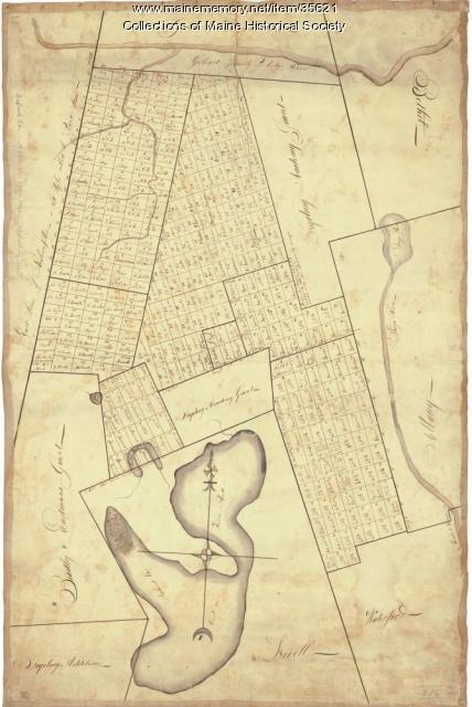
Contributed by: Maine Historical Society Date: circa 1792 Location: Stoneham; Lovell; Bethel; Albany; Mason Twp.; Bachelders Grant Media: Ink on fabric
