Keywords: Maps, Manuscript.
- Historical Items (364)
- Tax Records (0)
- Architecture & Landscape (0)
- Online Exhibits (9)
- Site Pages (96)
- My Maine Stories (0)
- Lesson Plans (0)
Historical Items
These results include photographs, documents, letters, paintings, artifacts, and many other kinds of Maine related items from collections around the state and elsewhere.
Item 102252
Plan of burial ground, Minot, ca. 1835
Contributed by: Maine Historical Society
Date: 1835
Location: Minot
Media: Ink on paper
This record contains 3 images.
Item 6883
St. John and Penobscot Rivers map, 1798
Contributed by: Maine Historical Society
Date: 1798-05-08
Location: Pleasant Point
Media: Ink on paper
This record contains 3 images.
Item 12631
Five farm lots, Bowdoinham, 1718
Contributed by: Maine Historical Society Date: 1718 Location: Bowdoinham Media: Ink on paper
Item 102072
Plan of Royalsborough, ca. 1766
Contributed by: Maine Historical Society Date: circa 1766 Location: Durham Media: Ink on vellum
Item 12563
Survey of settlers' lots in Norridgewock, 1802 and 1803
Contributed by: Maine Historical Society
Date: 1803
Location: Norridgewock
Media: Ink on paper
This record contains 2 images.
Item 116545
Contributed by: Maine Historical Society Date: circa 1820 Media: Ink on paper
Item 110355
Survey of lots, Georgetown, 1793
Contributed by: Maine Historical Society Date: circa 1780 Location: Lubec Media: Ink on paper
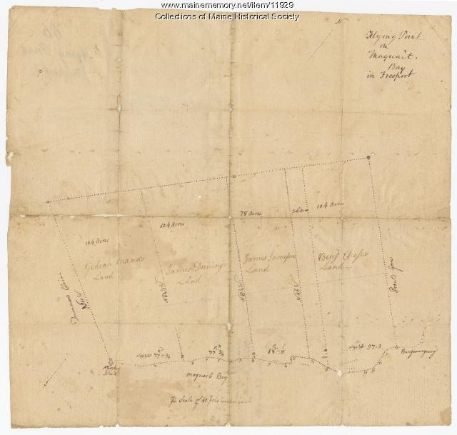
Item 11929
Flying Point at Maquoit Bay, Freeport, ca. 1770
Contributed by: Maine Historical Society Date: circa 1770 Location: Freeport; Brunswick Media: Ink on paper
Item 110893
Extract from a map of the British and French Dominions in North America, ca. 1845
Contributed by: Maine Historical Society
Date: circa 1755
Media: ink on paper
This record contains 2 images.
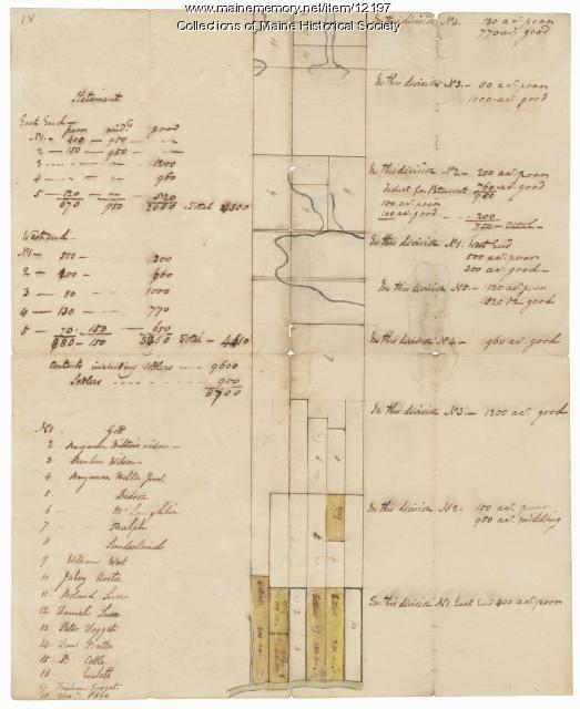
Item 12197
Division of the Tyng and Lowell estates, ca. 1760
Contributed by: Maine Historical Society
Date: circa 1760
Media: Ink on paper
This record contains 2 images.
Item 11728
Plan of a road in Brunswick, 1764
Contributed by: Maine Historical Society Date: 1764 Location: Brunswick; Bath Media: Ink on paper
Item 116493
Crooked Lake and Lake Namacan, ca. 1820
Contributed by: Maine Historical Society
Date: circa 1820
Media: Ink on paper
This record contains 2 images.
Item 10537
Contributed by: Maine Historical Society Date: 1717 Location: Brunswick Media: Ink on paper
Item 11754
Plan for towns along the Androscoggin River, ca. 1760
Contributed by: Maine Historical Society Date: circa 1760 Location: Livermore Falls; Canton; Mexico; Jay; Leeds Media: Ink on paper
Item 11731
William Patten's lot, Topsham, 1761
Contributed by: Maine Historical Society Date: 1761-11-24 Location: Topsham Media: Ink on paper
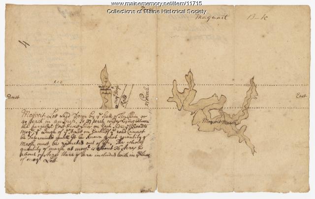
Item 11715
Plan of Maquoit Meadows, ca. 1720
Contributed by: Maine Historical Society Date: circa 1720 Location: Brunswick Media: Ink on paper
Item 116487
Canaan Corner, Northeast Boundary, ca. 1820
Contributed by: Maine Historical Society Date: circa 1820 Location: Canaan Media: Ink on paper
Item 11750
Contributed by: Maine Historical Society Date: 1770 Location: Durham Media: Ink on paper
Item 11736
Lots on Cathance River, Topsham, 1764
Contributed by: Maine Historical Society Date: 1764-02-28 Location: Topsham Media: Ink on paper
Item 12933
Wing's Mill Pond settlers' lots, ca. 1795
Contributed by: Maine Historical Society
Date: circa 1795
Location: Belgrade
Media: Ink on paper
This record contains 2 images.
Item 11923
Survey of Robert and John Donlop lots, Brunswick, 1757
Contributed by: Maine Historical Society Date: 1757 Location: Brunswick Media: Ink on paper
Item 12408
John Patten lot, Topsham, ca. 1760
Contributed by: Maine Historical Society Date: circa 1760 Location: Topsham Media: Ink on paper
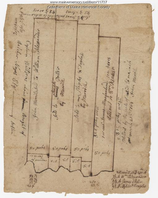
Item 11737
Contributed by: Maine Historical Society Date: 1764-04-07 Location: Topsham Media: Ink on paper
Item 5741
Detail from a Map of Portland Harbour and islands, 1825
Contributed by: Maine Historical Society Date: 1825 Location: Portland Media: Ink on paper, jpg


