Keywords: British -- America -- Maps -- Early works to 1800
- Historical Items (6)
- Tax Records (0)
- Architecture & Landscape (0)
- Online Exhibits (3)
- Site Pages (6)
- My Maine Stories (0)
- Lesson Plans (0)
Historical Items
These results include photographs, documents, letters, paintings, artifacts, and many other kinds of Maine related items from collections around the state and elsewhere.
Item 104604

New Map of English America, 1677
Contributed by: Osher Map Library and Smith Center for Cartographic Education Date: 1777 Media: Engraving
Item 11827
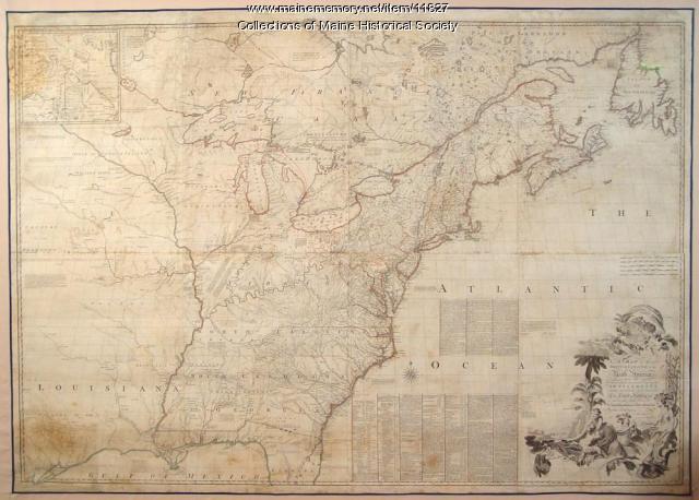
Map of the British and French North America, 1775
Contributed by: Maine Historical Society Date: 1755 Media: Ink on paper, map
Item 7494

Map of New England and New York, ca. 1676
Contributed by: Maine Historical Society Date: circa 1676 Media: Ink on paper
Item 116516

Extract from a Map of the British and French Dominions in North America, 1755
Contributed by: Maine Historical Society Date: circa 1755 Media: Ink on paper
Item 111012

A Plan of the Rivers Scoodich and Magaguadavic, including the Bay of Passamaquoddy, 1798
Contributed by: Maine Historical Society Date: 1798 Media: Ink on paper
Item 135901

Description of Pagan and Chipman’s Meetings with Francis Joseph Neptune, 1796
Contributed by: Maine Historical Society Date: 1796 Location: St. Andrews Media: Ink on Paper
