Keywords: Colonial Map
- Historical Items (391)
- Tax Records (0)
- Architecture & Landscape (2)
- Online Exhibits (16)
- Site Pages (101)
- My Maine Stories (0)
- Lesson Plans (1)
Historical Items
These results include photographs, documents, letters, paintings, artifacts, and many other kinds of Maine related items from collections around the state and elsewhere.
Item 135882
Contributed by: Osher Map Library and Smith Center for Cartographic Education Date: 1761 Media: Ink on paper
Item 104604
New Map of English America, 1677
Contributed by: Osher Map Library and Smith Center for Cartographic Education Date: 1777 Media: Engraving
Item 104601
Contributed by: Osher Map Library and Smith Center for Cartographic Education Date: 1677 Media: Woodcut
Item 108835
Plan of lots 1-10, Fairfield, 1782
Contributed by: Maine Historical Society
Date: 1782-12-20
Location: Fairfield
Media: Ink on paper
This record contains 2 images.
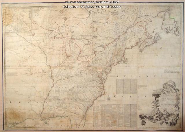
Item 11827
Map of the British and French North America, 1775
Contributed by: Maine Historical Society Date: 1755 Media: Ink on paper, map
Item 23341
Map of Cushing Island, ca. 1888
Contributed by: Maine Historical Society Date: circa 1888 Location: Portland Media: Ink on paper, map
Item 108837
Copy of Thomas Johnston's Plan of part of the Eastern Shore, ca. 1770
Contributed by: Maine Historical Society
Date: 1753
Media: Ink on paper
This record contains 2 images.
Item 13074
Manuscript map of Kennebec River area, 1771
Contributed by: Maine Historical Society Date: 1771 Media: Ink on paper
Item 7494
Map of New England and New York, ca. 1676
Contributed by: Maine Historical Society Date: circa 1676 Media: Ink on paper
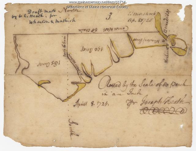
Item 11714
Contributed by: Maine Historical Society Date: 1725-04-08 Location: Brunswick Media: Ink on paper
Item 11726
Contributed by: Maine Historical Society
Date: 1795-05-29
Location: Brunswick; Durham; Freeport; Bath
Media: Ink on paper
This record contains 2 images.
Item 22383
Contributed by: Maine Historical Society Date: 1727 Location: North Yarmouth; Falmouth; Freeport Media: Ink on paper
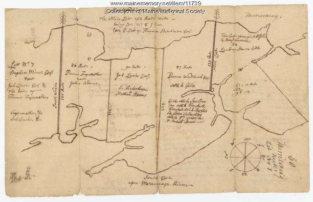
Item 11739
Contributed by: Maine Historical Society Date: 1771-06-17 Location: Harpswell Media: Ink on paper
Item 11743
Contributed by: Maine Historical Society Date: 1742-11-12 Location: Harpswell Media: Ink on paper
Item 11730
Contributed by: Maine Historical Society Date: 1761-11-12 Location: Topsham Media: Ink on paper
Item 11725
Contributed by: Maine Historical Society Date: 1772 Location: Brunswick Media: Ink on paper
Item 11741
Contributed by: Maine Historical Society Date: 1742 Location: Harpswell Media: Ink on paper
Item 12399
Map of Draper's Claim, near Bath, 1795
Contributed by: Maine Historical Society
Date: 1795
Media: Ink on paper
This record contains 2 images.
Item 12125
Map of Cobbosseecontee Stream, 1765
Contributed by: Maine Historical Society
Date: 1765-07-29
Location: Augusta; Gardiner; Farmingdale; Hallowell; Litchfield; Manchester; Winthrop; Monmouth
Media: Ink on paper
This record contains 2 images.
Item 11732
Contributed by: Maine Historical Society Date: circa 1760 Location: Topsham Media: Ink on paper
Item 11724
Map of Brunswick near the Narrows, 1737
Contributed by: Maine Historical Society
Date: 1737
Location: Brunswick; Topsham
Media: Ink on paper
This record contains 2 images.
Item 21566
Contributed by: Maine Historical Society Date: 1687 Location: North Yarmouth Media: Ink on paper
Item 12196
Map of Kennebec Purchase lots, ca. 1750
Contributed by: Maine Historical Society
Date: circa 1750
Media: Ink on paper
This record contains 2 images.
Item 102072
Plan of Royalsborough, ca. 1766
Contributed by: Maine Historical Society Date: circa 1766 Location: Durham Media: Ink on vellum


