Keywords: Maps
- Historical Items (952)
- Tax Records (0)
- Architecture & Landscape (275)
- Online Exhibits (36)
- Site Pages (267)
- My Maine Stories (8)
- Lesson Plans (6)
Historical Items
These results include photographs, documents, letters, paintings, artifacts, and many other kinds of Maine related items from collections around the state and elsewhere.
Item 105355
Contributed by: Osher Map Library and Smith Center for Cartographic Education Date: 1824 Media: Engraving
Item 11777
Contributed by: Maine Historical Society Date: circa 1905 Media: Ink on paper, map
Item 104782
Contributed by: Osher Map Library and Smith Center for Cartographic Education Date: 1793 Media: Engraving
Item 104600
Map of the District of Maine, 1815
Contributed by: Osher Map Library and Smith Center for Cartographic Education Date: 1815 Media: Engraving
Item 105353
"Geographical, statistical, and historical map of Maine," 1826
Contributed by: Osher Map Library and Smith Center for Cartographic Education Date: 1826 Media: Engraving
Item 105357
Map of the United States of America, 1821
Contributed by: Osher Map Library and Smith Center for Cartographic Education Date: 1821 Media: Engraving
Item 105359
The Moosehead Lake Region map, 1931
Contributed by: Osher Map Library and Smith Center for Cartographic Education Date: 1931 Media: Lithograph
Item 7489
Nova Anglia, Novum Belgium et Virginia, ca. 1642
Contributed by: Maine Historical Society Date: circa 1642 Media: Map, ink on paper
Item 104603
Map of the State of Maine, 1820
Contributed by: Osher Map Library and Smith Center for Cartographic Education Date: 1820 Media: Engraving
Item 31237
Moses Banks Map, Scarborough, 1787
Contributed by: Scarborough Historical Society & Museum Date: 1787 Location: Scarborough Media: Paper and ink
Item 7492
Novi Belgii: Novaeque Angliae Nec Non partis Virginiae, ca. 1655
Contributed by: Maine Historical Society Date: circa 1655 Media: Map, ink on paper
Item 34145
Old Homesteads in Scarborough, ca. 1950
Contributed by: Scarborough Historical Society & Museum Date: circa 1950 Location: Scarborough; Scarborough Media: Ink on paper, photograph
Item 104604
New Map of English America, 1677
Contributed by: Osher Map Library and Smith Center for Cartographic Education Date: 1777 Media: Engraving
Item 62841
Map of "The Plains," Waterville, 1911
Contributed by: Waterville Public Library Date: 1911 Location: Waterville; Waterville; Waterville Media: Ink on paper
Item 104601
Contributed by: Osher Map Library and Smith Center for Cartographic Education Date: 1677 Media: Woodcut
Item 7493
Nova Anglia Septentrionali, ca. 1759
Contributed by: Maine Historical Society Date: circa 1720 Media: Map ink on paper
Item 135882
Contributed by: Osher Map Library and Smith Center for Cartographic Education Date: 1761 Media: Ink on paper
Item 104783
Contributed by: Osher Map Library and Smith Center for Cartographic Education Date: 1794 Media: Engraving
Item 10832
Map by Francis Joseph Neptune, Cobscook River, 1798
Contributed by: Maine Historical Society
Date: 1798
Media: Ink on paper
This record contains 2 images.
Item 11963
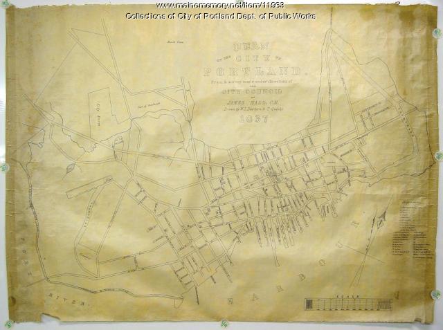
Plan of the City of Portland, 1837
Contributed by: City of Portland Dept. of Public Works Date: 1837 Location: Portland Media: Ink on paper, map
Item 30213
Contributed by: Prince Memorial Library Date: 1857 Location: Cumberland Media: Wall map, ink on paper
Item 105318
Map of the town of Camden, 1875
Contributed by: Osher Map Library and Smith Center for Cartographic Education Date: 1875 Location: Camden; Rockland Media: Lithograph
Item 7494
Map of New England and New York, ca. 1676
Contributed by: Maine Historical Society Date: circa 1676 Media: Ink on paper
Item 109022
Disputed lot E, Brunswick, 1811
Contributed by: Maine Historical Society
Date: 1811-09-03
Location: Brunswick
Media: Ink on paper
This record contains 3 images.


