Keywords: Roads -- Maine -- Maps
- Historical Items (154)
- Tax Records (0)
- Architecture & Landscape (51)
- Online Exhibits (23)
- Site Pages (63)
- My Maine Stories (4)
- Lesson Plans (0)
Historical Items
These results include photographs, documents, letters, paintings, artifacts, and many other kinds of Maine related items from collections around the state and elsewhere.
Item 11777

Contributed by: Maine Historical Society Date: circa 1905 Media: Ink on paper, map
Item 104600

Map of the District of Maine, 1815
Contributed by: Osher Map Library and Smith Center for Cartographic Education Date: 1815 Media: Engraving
Item 31237

Moses Banks Map, Scarborough, 1787
Contributed by: Scarborough Historical Society & Museum Date: 1787 Location: Scarborough Media: Paper and ink
Item 34145

Old Homesteads in Scarborough, ca. 1950
Contributed by: Scarborough Historical Society & Museum Date: circa 1950 Location: Scarborough; Scarborough Media: Ink on paper, photograph
Item 105362

Contributed by: Osher Map Library and Smith Center for Cartographic Education Date: 1833 Media: Engraving
Item 4319

Contributed by: Maine Historical Society Date: circa 1795 Location: Freeport; New Gloucester; Brunswick Media: Ink on paper
Item 62538

General Plan for Western Promenade, Portland, 1905
Contributed by: Maine Historical Society Date: 1905 Location: Portland Media: Ink on paper
Item 149689

County Map of the State of Maine, 1860
Contributed by: Acadian Archives Date: 1860 Media: Ink on paper
Item 148717

Map of the southern half of T3 R13, 1909
Contributed by: Maine Historical Society Date: 1909 Location: T3 R13 WELS Media: Ink on paper
Item 31883

Map of Cumberland County, 1880
Contributed by: North Yarmouth Historical Society Date: 1880 Media: Ink on paper
Item 28286

Contributed by: Lang Smith through Islesboro Historical Society Date: 1884 Location: Islesboro Media: Ink on paper
Item 105358

The Phillips Road and Trail Map of Baxter State Park, 1972
Contributed by: Osher Map Library and Smith Center for Cartographic Education Date: 1972 Location: Millinocket Media: Lithograph
Item 12937
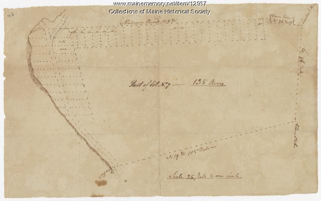
Map of lot no. 7, 135 acres on Madison Road, Skowhegan, ca. 1760
Contributed by: Maine Historical Society Date: circa 1760 Location: Skowhegan Media: Ink on paper
Item 66609

Map of Mt. Desert Island printed on postcard, ca. 1935
Contributed by: Boston Public Library Date: circa 1935 Location: Mount Desert Island Media: Linen texture postcard
Item 4174

Map of Portland and vicinity, 1900
Contributed by: Maine Historical Society Date: 1900 Location: Portland Media: Paper
Item 20766

Manuscript Map of Moose River, Moosehead Lake, and Kennebeck Road, 1820
Contributed by: Maine Historical Society Date: 1820 Media: Ink on paper
Item 110936

Map of Campobello Island, ca. 1840
Contributed by: Maine Historical Society Date: circa 1840 Location: Campobello Island Media: Ink on paper
Item 68865

Contributed by: Maine Historical Society Date: 1784 Location: Scarborough Media: Ink on paper
Item 11728

Plan of a road in Brunswick, 1764
Contributed by: Maine Historical Society Date: 1764 Location: Brunswick; Bath Media: Ink on paper
Item 68874

Sheepscot Farms, Wiscasset, 1877
Contributed by: Maine Historical Society Date: 1877 Location: Wiscasset Media: Ink on paper
Item 116542

A Map of Campobello and other islands in the Province of New Brunswick, 1830
Contributed by: Maine Historical Society Date: 1830 Location: Campobello Island Media: Ink on paper
Item 10890

Contributed by: Maine Historical Society Date: 1909 Location: Portland Media: Ink on paper
Item 12558

Contributed by: Maine Historical Society Date: circa 1800 Location: Skowhegan Media: Ink on paper
Item 102072

Plan of Royalsborough, ca. 1766
Contributed by: Maine Historical Society Date: circa 1766 Location: Durham Media: Ink on vellum
