Keywords: land division
- Historical Items (28)
- Tax Records (0)
- Architecture & Landscape (0)
- Online Exhibits (18)
- Site Pages (38)
- My Maine Stories (6)
- Lesson Plans (0)
Historical Items
These results include photographs, documents, letters, paintings, artifacts, and many other kinds of Maine related items from collections around the state and elsewhere.
Item 102068
"Tract of land lying in Poland," 1798
Contributed by: Maine Historical Society Date: 1798 Location: Auburn; Poland; Minot; Turner Media: Ink on paper
Item 108765
Edward Little plan of lots, ca. 1820
Contributed by: Maine Historical Society Date: circa 1820 Media: Ink on paper
Item 102070
Early map of Lewiston, Auburn and Minot, ca. 1820
Contributed by: Maine Historical Society Date: circa 1820 Location: Auburn; Lewiston; Minot Media: Ink on paper
Item 6847
Plan of a division of land belonging to Dominicus Jordan, 1751
Contributed by: Maine Historical Society Date: 1751 Location: Cape Elizabeth Media: Ink on paper
Item 102252
Plan of burial ground, Minot, ca. 1835
Contributed by: Maine Historical Society
Date: 1835
Location: Minot
Media: Ink on paper
This record contains 3 images.
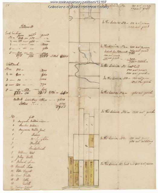
Item 12197
Division of the Tyng and Lowell estates, ca. 1760
Contributed by: Maine Historical Society
Date: circa 1760
Media: Ink on paper
This record contains 2 images.
Item 102072
Plan of Royalsborough, ca. 1766
Contributed by: Maine Historical Society Date: circa 1766 Location: Durham Media: Ink on vellum
Item 102071
Map of early Greene, Lewiston and Sabattus, ca. 1790
Contributed by: Maine Historical Society Date: circa 1790 Location: Sabattus; Greene Media: Ink on vellum
Item 112083
Pejepscot Company Records, Volume 1A, 1683-1814
Contributed by: Maine Historical Society
Date: 1683–1814
Location: Brunswick
Media: Ink on paper
This record contains 309 images.
Item 112085
Pejepscot Company Records, Volume 2, 1767-1818
Contributed by: Maine Historical Society
Date: 1767–1818
Location: Brunswick; Durham; Topsham
Media: Ink on paper
This record contains 136 images.
Item 112086
Pejepscot Company Records, Volume 3, 1717-1781
Contributed by: Maine Historical Society
Date: 1717–1781
Location: Brunswick
Media: Ink on paper
This record contains 201 images.
Item 112092
Pejepscot Company Records, Volume 10, 1670-1840
Contributed by: Maine Historical Society
Date: 1670–1840
Location: Brunswick; Harpswell
Media: Ink on paper
This record contains 764 images.
Item 112089
Pejepscot Company Records, Volume 6, 1730-1821
Contributed by: Maine Historical Society
Date: 1730–1821
Location: Boothbay Harbor; Bowdoinham; Brunswick; Harpswell
Media: Ink on paper
This record contains 427 images.
Item 68866
Libby River land, Scarborough, 1794
Contributed by: Maine Historical Society Date: 1794 Location: Scarborough Media: Ink on paper, map
Item 112090
Pejepscot Company Records, Volume 7, 1694-1853
Contributed by: Maine Historical Society
Date: 1694–1853
Location: Brunswick
Media: Ink on paper
This record contains 1057 images.
Item 108959
Plat of a tract of land in Woolwich, 1751
Contributed by: Patten Free Library Date: 1751-11-29 Location: Woolwich Media: Watercolor on paper
Item 12562
Part of the Pownalborough plan, Augusta and Dresden, ca. 1760
Contributed by: Maine Historical Society
Date: circa 1760
Location: Augusta; Dresden; Pittston; Randolph; Alna
Media: Ink on paper
This record contains 2 images.
Item 102073
Map of Lewiston and Auburn, 1851
Contributed by: Maine Historical Society Date: 1851 Location: Lewiston; Auburn Media: Ink on paper
Item 67668
Aquia Creek Landing, Virginia, ca. 1863
Contributed by: Library of Congress Prints and Photographs Division through Maine Historical Society Date: circa 1863 Location: Aquia Creek Media: Digital image of glass negative
Item 112087
Pejepscot Company Records, Volume 4, 1627-1866
Contributed by: Maine Historical Society
Date: 1627–1866
Location: Brunswick
Media: Ink on paper
This record contains 529 images.
Item 13074
Manuscript map of Kennebec River area, 1771
Contributed by: Maine Historical Society Date: 1771 Media: Ink on paper
Item 103929
Pepperell's vacant Mill #2, Biddeford, 2015
Contributed by: Biddeford Mills Museum Date: circa 1854 Location: Biddeford Media: Digital Image
Item 68865
Contributed by: Maine Historical Society Date: 1784 Location: Scarborough Media: Ink on paper
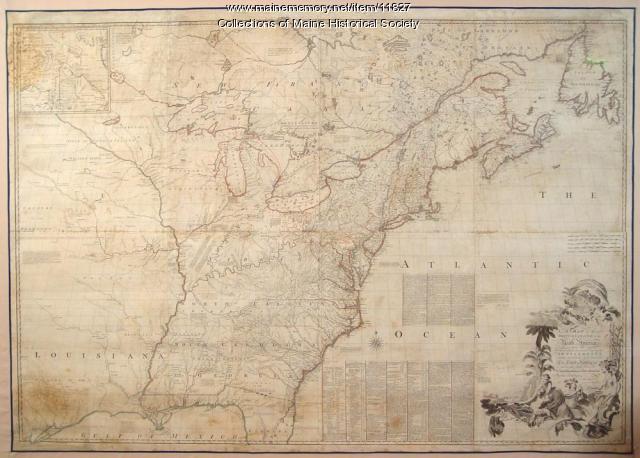
Item 11827
Map of the British and French North America, 1775
Contributed by: Maine Historical Society Date: 1755 Media: Ink on paper, map


