LC Subject Heading: Maps -- Maine.
- Historical Items (70)
- Tax Records (0)
- Architecture & Landscape (0)
- Online Exhibits (0)
- Site Pages (0)
- My Maine Stories (0)
- Lesson Plans (0)
Historical Items
These results include photographs, documents, letters, paintings, artifacts, and many other kinds of Maine related items from collections around the state and elsewhere.
Item 105273

Map of the State of Maine, 1861
Contributed by: Osher Map Library and Smith Center for Cartographic Education Date: 1861 Media: Lithograph
Item 4175

Plan of the City of Portland, 1837
Contributed by: Maine Historical Society Date: 1837 Location: Portland Media: Paper
Item 22212

Contributed by: Aroostook County Historical and Art Museum Date: circa 1870 Location: Houlton Media: Ink on paper
Item 10890

Contributed by: Maine Historical Society Date: 1909 Location: Portland Media: Ink on paper
Item 22699

Contributed by: Maine Historical Society Date: circa 1875 Location: Portland Media: Lantern slide
Item 4174

Map of Portland and vicinity, 1900
Contributed by: Maine Historical Society Date: 1900 Location: Portland Media: Paper
Item 11968
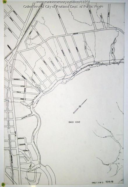
Filling in Back Cove, Portland, part 2, 1837-2003
Contributed by: City of Portland Dept. of Public Works Date: 1837–2003 Location: Portland Media: Ink on paper
Item 12098

Contributed by: Aroostook County Historical and Art Museum Date: 1894 Location: Houlton Media: Ink on paper
Item 12100

Contributed by: Aroostook County Historical and Art Museum Date: 1887 Location: Houlton Media: Ink on paper
Item 78950

Salem Towne Map, Mount Desert Island, ca. 1808
Contributed by: Mount Desert Island Historical Society Date: circa 1808 Location: Mount Desert Island Media: Map
Item 4168

Contributed by: Maine Historical Society Date: 1690 Location: Portland Media: Ink on paper
Item 10887

Map from Hay's Guide to Portland and Motoring in Maine, 1928
Contributed by: Maine Historical Society Date: 1928 Media: Ink on paper, map
Item 100830

Contributed by: Pittsfield Historical Society Date: 1894 Location: Newport Media: Ink on paper
Item 105362

Contributed by: Osher Map Library and Smith Center for Cartographic Education Date: 1833 Media: Engraving
Item 149659

Map for Martin's Sporting Camps, Sinclair, 1953
Contributed by: Acadian Archives Date: 1953 Location: Square Lake Media: Postcard
Item 10067

Contributed by: Maine Historical Society Date: circa 1780 Location: Gray Media: Ink on paper
Item 4173

Contributed by: Maine Historical Society Date: 1866 Location: Portland Media: Ink on paper
Item 4176

Falmouth Neck before burning, 1775
Contributed by: Maine Historical Society Date: 1775-10-18 Location: Portland Media: Paper
Item 4181

Contributed by: Maine Historical Society Date: 1874 Media: Paper
Item 4182

Plan of Rascoheegan alias Parker's Island, 1759
Contributed by: Maine Historical Society Date: 1759 Location: Georgetown Media: Ink on paper
Item 11777

Contributed by: Maine Historical Society Date: circa 1905 Media: Ink on paper, map
Item 11854

Moses Greenleaf's Map of the inhabited part of the state of Maine, 1829
Contributed by: Maine Historical Society Date: 1778 Media: Ink wash on lithograph, Map
Item 17584

Contributed by: Maine Historical Society Date: 1917 Media: Ink on paper
Item 33912

Orchard Plan, Blue Hill, ca. 1800
Contributed by: Jonathan Fisher Memorial, Inc. Date: circa 1800 Location: Blue Hill Media: Ink on paper
