Keywords: Island River
- Historical Items (281)
- Tax Records (0)
- Architecture & Landscape (0)
- Online Exhibits (48)
- Site Pages (140)
- My Maine Stories (9)
- Lesson Plans (0)
Online Exhibits
Your results include these online exhibits. You also can view all of the site's exhibits, view a timeline of selected events in Maine History, and learn how to create your own exhibit. See featured exhibits or create your own exhibit
Exhibit

MY ISLAND HOME: Verlie Colby Greenleaf of Westport Island
Verlie Greenleaf (1891-1992) bore witness to over a century of Westport Island's history. Many changes occurred during Verlie's 100-year life. Verlie Greenleaf donated photographs, personal notes, and sat for an interview in 1987, all part of the Westport Island History Committee's collection. Her words frame this exhibition, providing a first-person account of her life.
Exhibit

Student Exhibit: Logging on Kennebec River
I became interested in the Kennebec River log drive when my grandfather would tell me stories. He remembers watching the logs flow down the river from his home in Fairfield, a small town along the Kennebec River.
Exhibit

Melting snow, ice, warmer temperatures, and rain sometimes bring floods to Maine's many rivers and streams. Floods are most frequent in the spring, but can occur at any season.
Exhibit
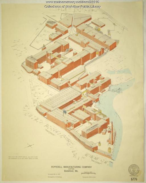
Biddeford, Saco and the Textile Industry
The largest textile factory in the country reached seven stories up on the banks of the Saco River in 1825, ushering in more than a century of making cloth in Biddeford and Saco. Along with the industry came larger populations and commercial, retail, social, and cultural growth.
Exhibit

For one hundred years, Acadia National Park has captured the American imagination and stood as the most recognizable symbol of Maine’s important natural history and identity. This exhibit highlights Maine Memory content relating to Acadia and Mount Desert Island.
Exhibit

Jay & Livermore Falls, Pioneers in Paper Making
Alvin Record and Hugh J. Chisholm were instrumental in building paper mills in Jay, Livermore, and Livermore Falls. The two industrialists helped make the towns prosperous.
Exhibit

Wired! How Electricity Came to Maine
As early as 1633, entrepreneurs along the Piscataqua River in southern Maine utilized the force of the river to power a sawmill, recognizing the potential of the area's natural power sources, but it was not until the 1890s that technology made widespread electricity a reality -- and even then, consumers had to be urged to use it.
Exhibit

Colonial Cartography: The Plymouth Company Maps
The Plymouth Company (1749-1816) managed one of the very early land grants in Maine along the Kennebec River. The maps from the Plymouth Company's collection of records constitute some of the earliest cartographic works of colonial America.
Exhibit

The British capture and occupation of Eastport 1814-1818
The War of 1812 ended in December 1814, but Eastport continued to be under British control for another four years. Eastport was the last American territory occupied by the British from the War of 1812 to be returned to the United States. Except for the brief capture of two Aleutian Islands in Alaska by the Japanese in World War II, it was the last time since 2018 that United States soil was occupied by a foreign government.
Exhibit

Princeton: Woods and Water Built This Town
Princeton benefited from its location on a river -- the St. Croix -- that was useful for transportation of people and lumber and for powering mills as well as on its proximity to forests.
Exhibit

Visitors to the Maine woods in the early twentieth century often recorded their adventures in private diaries or journals and in photographs. Their remembrances of canoeing, camping, hunting and fishing helped equate Maine with wilderness.
Exhibit

A Town Is Born: South Bristol, 1915
After being part of the town of Bristol for nearly 150 years, residents of South Bristol determined that their interests would be better served by becoming a separate town and they broke away from the large community of Bristol.
Exhibit

Bowdoin College Scientific Expedition to Labrador
"The Bowdoin Boys" -- some students and recent graduates -- traveled to Labrador in 1891 to collect artifacts, specimens, and to try to find Grand Falls, a waterfall deep in Labrador's interior.
Exhibit

Building the International Appalachian Trail
Wildlife biologist Richard Anderson first proposed the International Appalachian Trail (IAT) in 1993. The IAT is a long-distance hiking trail along the modern-day Appalachian, Caledonian, and Atlas Mountain ranges, geological descendants of the ancient Central Pangean Mountains. Today, the IAT stretches from the Katahdin Woods and Waters National Monument in Maine, through portions of Canada, Greenland, Iceland, the Faroe Islands, and Europe, and into northern Africa.
Exhibit

Student Exhibit: Benedict Arnold's March Through Skowhegan
Benedict Arnold arrived in Skowhegan on October 4th, 1775, and it was here that Arnold received his first offer of help from the colonists. Joseph Weston and his sons helped Benedict Arnold and his army cross over the Skowhegan Falls, but Joseph later got a severe cold from exposure and died of a fever on Oct.16th. His sons went back to the family home along the Kennebec for they were the first family to settle in Old Canaan or what is now Skowhegan.
Exhibit

After the canoe, steamboats became the favored method of transportation on Moosehead Lake. They revolutionized movement of logs and helped promote tourism in the region.
Exhibit

The boundaries of Maine are the product of international conflict, economic competition, political fights, and contested development. The boundaries are expressions of human values; people determined the shape of Maine.
Exhibit

Washington County Through Eastern's Eye
Images taken by itinerant photographers for Eastern Illustrating and Publishing Company, a real photo postcard company, provide a unique look at industry, commerce, recreation, tourism, and the communities of Washington County in the early decades of the twentieth century.
Exhibit

Photojournalism & the 1936 Flood
Photojournalism & the 1936 Flood examines the monumental destruction caused by the historic flood of 1936 through the comprehensive and innovative photojournalism done by the Guy Gannett Publishing Company in the weeks surrounding the flood.
Exhibit

Immigration is one of the most debated topics in Maine. Controversy aside, immigration is also America's oldest tradition, and along with religious tolerance, what our nation was built upon. Since the first people--the Wabanaki--permitted Europeans to settle in the land now known as Maine, we have been a state of immigrants.
Exhibit

From Sewers to Skylines: William S. Edwards's 1887 Photo Album
William S. Edwards (1830-1918) was a civil engineer who worked for the City of Portland from 1876-1906. Serving as First Assistant to Chief Engineer William A. Goodwin, then to Commissioner George N. Fernald, Edwards was a fixture in City Hall for 30 consecutive years, proving indispensable throughout the terms of 15 Mayors of Portland, including all six of those held by James Phineas Baxter. Edwards made significant contributions to Portland, was an outstanding mapmaker and planner, and his works continue to benefit historians.
Exhibit

The Schooner Bowdoin: Ninety Years of Seagoing History
After traveling to the Arctic with Robert E. Peary, Donald B. MacMillan (1874-1970), an explorer, researcher, and lecturer, helped design his own vessel for Arctic exploration, the schooner <em>Bowdoin,</em> which he named after his alma mater. The schooner remains on the seas.
Exhibit

Workers in Maine have labored in factories, on farms, in the woods, on the water, among other locales. Many of Maine's occupations have been determined by the state's climate and geographical features.
Exhibit

Maine has some 17 million acres of forest land. But even on a smaller, more local scale, trees have been an important part of the landscape. In many communities, tree-lined commercial and residential streets are a dominant feature of photographs of the communities.
