Keywords: company
- Historical Items (5487)
- Tax Records (854)
- Architecture & Landscape (158)
- Online Exhibits (147)
- Site Pages (554)
- My Maine Stories (58)
- Lesson Plans (2)
Online Exhibits
Your results include these online exhibits. You also can view all of the site's exhibits, view a timeline of selected events in Maine History, and learn how to create your own exhibit. See featured exhibits or create your own exhibit
Exhibit

Colonial Cartography: The Plymouth Company Maps
The Plymouth Company (1749-1816) managed one of the very early land grants in Maine along the Kennebec River. The maps from the Plymouth Company's collection of records constitute some of the earliest cartographic works of colonial America.
Exhibit

Sagadahoc County through the Eastern Eye
The Eastern Illustrating and Publishing Company of Belfast, Maine. employed photographers who traveled by company vehicle through New England each summer, taking pictures of towns and cities, vacation spots and tourist attractions, working waterfronts and local industries, and other subjects postcard recipients might enjoy. The cards were printed by the millions in Belfast into the 1940s.
Exhibit

Lincoln County through the Eastern Eye
The Penobscot Marine Museum’s photography collections include nearly 50,000 glass plate negatives of images for "real photo" postcards produced by the Eastern Illustrating and Publishing Company of Belfast. This exhibit features postcards from Lincoln County.
Exhibit

Washington County Through Eastern's Eye
Images taken by itinerant photographers for Eastern Illustrating and Publishing Company, a real photo postcard company, provide a unique look at industry, commerce, recreation, tourism, and the communities of Washington County in the early decades of the twentieth century.
Exhibit

Settling along the Androscoggin and Kennebec
The Proprietors of the Township of Brunswick was a land company formed in 1714 and it set out to settle lands along the Androscoggin and Kennebec Rivers in Maine.
Exhibit

Paper has shaped Maine's economy, molded individual and community identities, and impacted the environment throughout Maine. When Hugh Chisholm opened the Otis Falls Pulp Company in Jay in 1888, the mill was one of the most modern paper-making facilities in the country, and was connected to national and global markets. For the next century, Maine was an international leader in the manufacture of pulp and paper.
Exhibit

At the heyday of trolleys in Maine, many of the trolley companies developed recreational facilities along or at the end of trolley lines as one further way to encourage ridership. The parks often had walking paths, dance pavilions, and various other entertainments. Cutting-edge technology came together with a thirst for adventure and forever changed social dynamics in the process.
Exhibit

Photojournalism & the 1936 Flood
Photojournalism & the 1936 Flood examines the monumental destruction caused by the historic flood of 1936 through the comprehensive and innovative photojournalism done by the Guy Gannett Publishing Company in the weeks surrounding the flood.
Exhibit

Maine Streets: The Postcard View
Photographers from the Eastern Illustrating and Publishing Co. of Belfast traveled throughout the state, especially in small communities, taking images for postcards. Many of these images, taken in the first three decades of the twentieth century, capture Main Streets on the brink of modernity.
Exhibit

Jay & Livermore Falls, Pioneers in Paper Making
Alvin Record and Hugh J. Chisholm were instrumental in building paper mills in Jay, Livermore, and Livermore Falls. The two industrialists helped make the towns prosperous.
Exhibit

In 1893, F.C. Whitehouse of Topsham, who owned paper mills in Topsham and Lisbon Falls, began construction of a third mill on the eastern banks of the Androscoggin River five miles north of Topsham. First, he had to build a dam to harness the river's power.
Exhibit

Yarmouth's "Third Falls" provided the perfect location for papermaking -- and, soon, for producing soda pulp for making paper. At the end of the 19th century and beginning of the 20th, Yarmouth was an international leader in soda pulp production.
Exhibit

Silk Manufacturing in Westbrook
Cultivation of silkworms and manufacture of silk thread was touted as a new agricultural boon for Maine in the early 19th century. However, only small-scale silk production followed. In 1874, the Haskell Silk Co. of Westbrook changed that, importing raw silk, and producing silk machine twist threat, then fabrics, until its demise in 1930.
Exhibit

The boundaries of Maine are the product of international conflict, economic competition, political fights, and contested development. The boundaries are expressions of human values; people determined the shape of Maine.
Exhibit

The small town of Andover landed on the international map in 1962 when the Earth Station that had been built there successfully communicated with Telstar, the first telecommunications satellite.
Exhibit

Workers in Maine have labored in factories, on farms, in the woods, on the water, among other locales. Many of Maine's occupations have been determined by the state's climate and geographical features.
Exhibit

After the canoe, steamboats became the favored method of transportation on Moosehead Lake. They revolutionized movement of logs and helped promote tourism in the region.
Exhibit

J.A. Poor and the Portland-Montreal Connection
John A. Poor's determination in 1845 to bring rail service to Maine and to make Portland the winter port for Montreal, along with the steel foundry he started to build locomotives and many other products, helped boost the economy of Portland the state.
Exhibit

Wired! How Electricity Came to Maine
As early as 1633, entrepreneurs along the Piscataqua River in southern Maine utilized the force of the river to power a sawmill, recognizing the potential of the area's natural power sources, but it was not until the 1890s that technology made widespread electricity a reality -- and even then, consumers had to be urged to use it.
Exhibit

The Swinging Bridge: Walking Across the Androscoggin
Built in 1892 to entice workers at the Cabot Manufacturing Corporation in Brunswick to move to newly built housing in Topsham, the Androscoggin Pedestrian "Swinging" Bridge or Le Petit Pont quickly became important to many people traveling between the two communities.
Exhibit
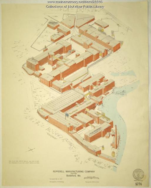
Biddeford, Saco and the Textile Industry
The largest textile factory in the country reached seven stories up on the banks of the Saco River in 1825, ushering in more than a century of making cloth in Biddeford and Saco. Along with the industry came larger populations and commercial, retail, social, and cultural growth.
Exhibit

The paper mill on the Penobscot River in South Brewer, which became known as Eastern Fine Paper Co., began as a sawmill in 1884 and grew over the years as an important part of the economy of the region and a large presence in the landscape. Its closing in 2005 affected more than the men and women who lost their jobs.
Exhibit

Walter Wyman's vision to capture the power of Maine's rivers to produce electricity led to the formation of Central Maine Power Co. and to a struggle within the state over what should happen to the power produced by the state's natural resources.
Exhibit

Construction of the Bangor and Aroostook rail lines into northern Aroostook County in the early twentieth century opened the region to tourism and commerce from the south.
