Keywords: Boat landings
- Historical Items (144)
- Tax Records (1)
- Architecture & Landscape (0)
- Online Exhibits (35)
- Site Pages (179)
- My Maine Stories (4)
- Lesson Plans (1)
Site Pages
These sites were created for each contributing partner or as part of collaborative community projects through Maine Memory. Learn about collaborative projects on MMN.
Site Page
"Fixing Borders on the Land: The Northeastern Boundary in Treaties and Local Reality, 1763-1842 St."
Site Page
"Fixing Borders on the Land: The Northeastern Boundary in Treaties and Local Reality, 1763-1842 Essay by Liam Riordan Riordan is American historian…"
Site Page
"Fixing Borders on the Land: The Northeastern Boundary in Treaties and Local Reality, 1763-1842 Manuscript Map of Moose River, Moosehead Lake…"
Site Page
"Fixing Borders on the Land: The Northeastern Boundary in Treaties and Local Reality, 1763-1842 While national and imperial leaders were pleased…"
Site Page
"Fixing Borders on the Land: The Northeastern Boundary in Treaties and Local Reality, 1763-1842 British survey highlands map, ca."
Site Page
Scarborough: They Called It Owascoag - Scarborough Marsh: "Land of Much Grass" - Page 3 of 4
"Scarborough Marsh: "Land of Much Grass" Site of Scarborough Marsh Audubon CenterScarborough Historical Society & Museum Realizing that this…"
Site Page
Scarborough: They Called It Owascoag - Scarborough Marsh: "Land of Much Grass" - Page 1 of 4
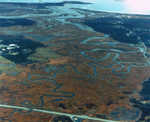
"… Scarborough Marsh: "Land of Much Grass" aerial view of marsh X Text by Bruce Thurlow Images from Scarborough Historical Society, Bruce…"
Site Page
Scarborough: They Called It Owascoag - Scarborough Marsh: "Land of Much Grass" - Page 4 of 4
"Scarborough Marsh: "Land of Much Grass" Sources Dunstan River X Acts and Resolves of the Legislature of Maine."
Site Page
Scarborough: They Called It Owascoag - Scarborough Marsh: "Land of Much Grass" - Page 2 of 4
"Scarborough Marsh: "Land of Much Grass" Moses Banks MapScarborough Historical Society & Museum The Scarborough Marsh has long been important…"
Site Page
"Many others came under the auspices of no land company at all. During the Revolutionary War, scores of leading proprietors remained loyal to the…"
Site Page
"… and Topsham residents who squatted on unsold land, stalled on payments, or helped themselves to timber on company land, while arguing that, by…"
Site Page
"… and Pejepscot Proprietors? Residents on company lands also complained, with considerable justification, about suffering as a result of rivalries…"
Site Page
"Robert Kinney's Land on the Plains, and hinder any Person from Lumbering or Tresspassing" These letters were given to many settlers on disputed land…"
Site Page
"Positioning itself as the sole source of legal title to “unappropriated” land, the state government itself began to compete with the great…"
Site Page
Beyond Borders - Mapping Maine and the Northeast Boundary - Further Reading
"Blaakman, Michael Albert. Speculation Nation: Land and Mania in the Revolutionary American Republic, 1776-1803. New Haven, CT: Yale University, 2016."
Site Page
"… questions continued to plague would-be land speculators and even governmental officials looking to bring White settlers into the region to bolster…"
Site Page
"James signed above Rachel on the land deed, exemplifying the intertwining of husbands’ and wives’ economic fortunes through marriage.(4) Overall…"
Site Page
"By absorbing everything east of the Kennebec into Nova Scotia, where land could be granted and organized by Royal decree, Dunbar’s settlement efforts…"
Site Page
"… Wharton in 1684 with six Wabanaki sagamores to land around Merrymeeting Bay, the Androscoggin and Kennebec Rivers."
Site Page
Beyond Borders - Mapping Maine and the Northeast Boundary - Project Home
"… important contemporary topics such as Indigenous land and water rights; and the preservation and use of public lands."
Site Page
"… to see the same leaders sign deeds for the same land, with different settlers. For example, “Robin Hood” or Ramegin, appeared on more than fifteen…"
Site Page
"… Society The protection of these relationships to land and kin are evident in the ways that Wabanaki leaders sought to reserve subsistence rights."
Site Page
"… European settlers only—to have full title to land, even though they had to keep fighting over which European’s claims were to win the day."
Site Page
"… to delineate the boundaries of settler claims to land, Pial Pôl’s presence, in 1793, also speaks to the Wabanaki people who remained."


