Keywords: Androscoggin River (N.H. and Me.)Androscoggin River (N.H. and Me.)
- Historical Items (144)
- Tax Records (0)
- Architecture & Landscape (1)
- Online Exhibits (6)
- Site Pages (90)
- My Maine Stories (0)
- Lesson Plans (0)
Site Pages
These sites were created for each contributing partner or as part of collaborative community projects through Maine Memory. Learn about collaborative projects on MMN.
Site Page
Western Maine Foothills Region - Regional and Town History
"The Androscoggin, Nezinscot, Ellis, Swift, Webb, and Twenty Mile Rivers all provided water power for mills and factories producing products of every…"
Site Page
Western Maine Foothills Region - Building Boom and Piers above the Falls
"Here is the letter from Waldo Pettengill to Hugh J. Chisholm regarding plans to build the booms and piers for the mill. Mr."
Site Page

Western Maine Foothills Region - Rumford - Page 4 of 4
"… in the sky, water rushing over granite rock, the Androscoggin River flowing high with melting winter snows from fields, from dark forests, water…"
Site Page

Western Maine Foothills Region - Mexico - Page 2 of 3
"The old Indian trail extending up along the Androscoggin River through Dixfield, Mexico, and Rumford, and then on up into the lakes is worthy of…"
Site Page
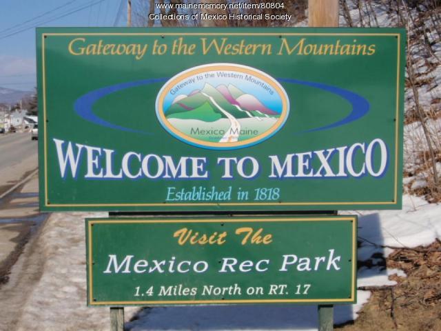
Western Maine Foothills Region - Mexico - Page 1 of 3
"In 1798 a road to the Swift River along the Androscoggin River was built and called Rumford Road, now River Road."
Site Page

Western Maine Foothills Region - Hugh J. Chisholm, Sr. - Page 1 of 2
"… Area Historical Society Chisholm’s taming of the Androscoggin River, through construction of a dam at the head of the Falls; digging a canal to…"
Site Page

Western Maine Foothills Region - Ridlonville
"Ridlon built a hotel on this land, which soon housed a post office, store, and many houses to accomodate the influx of Italian, Lithuanian, Polish…"
Site Page

Western Maine Foothills Region - Mexico Corner
"Thus began a period of great growth and prosperity for this community. Sources: A Story of the Town of Mexico 1818-1968, Ruby Bragdon -Theresa Thomas…"
Site Page

Western Maine Foothills Region - Rumford - Page 3 of 4
"The Androscoggin River and its tributaries are now relatively free of pollution and are suitable for swimming, boating, and fishing in the Rumford…"
Site Page

Western Maine Foothills Region - Rumford - Page 1 of 4
"… and social development to its location on the Androscoggin River, and its tributaries of the Ellis River on the west, the Swift River on the east…"
Site Page

Western Maine Foothills Region - Dixfield - Page 4 of 5
"Agriculture played a part in the development of this section of town, too. Scattered farms were located just “above the hill” going towards Carthage…"
Site Page

Western Maine Foothills Region - Hugh J. Chisholm, Sr. - Page 2 of 2
"He generously contributed lands for various churches to be built in Rumford. He believed in healthy living and provided a free public skating rink to…"
Site Page
Western Maine Foothills Region - Mt. Zircon Reservoir - Page 2 of 3
"Zircon Brook and the Androscoggin River. His granddaughter, Janette West Blouin, who still resides next to the existing West farm, recalls hearing…"
Site Page

Western Maine Foothills Region - Dixfield - Page 1 of 5
"A Revolutionary Was soldier, Col. Jonathan Holman of Sutton, Massachusetts, had heard reports and was spurred on to explore what would become the…"
Site Page

Western Maine Foothills Region - Peru
"… the New Hampshire border on the south side of the Androscoggin River and was bordered by Township Number Two (now known as Milton Plantation)…"
Site Page

Western Maine Foothills Region - About the Project
"The Androscoggin River Valley towns of MSAD’s 21 and 43 have traditionally close ties, and that part of the merger made a natural fit."
Site Page

Western Maine Foothills Region - Rumford - Page 2 of 4
"… Thurston’s or “winter" School on the shore of the Androscoggin River near the Aaron Graham/Bartlett/Welch farm, which the south-side children…"
Site Page

Western Maine Foothills Region - Fires in Rumford
"It became apparent by 7:00 p.m., with the fire having spread to both sides of Waldo Street and to houses on Falmouth and Hancock Streets, that…"
Site Page
Western Maine Foothills Region - For The Love Of Paper - Page 1 of 4
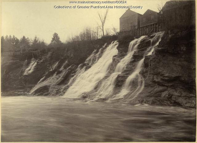
"Hugh heard of the great water falls of the Androscoggin River located in Rumford, Maine and made venture to see for himself."
Site Page

"The eight original Pejepscot Proprietors quickly founded Brunswick and Topsham, and spent the next few decades struggling to recruit…"
Site Page

"He explained the location of particular Wabanaki places, such as Quabecook (Merrymeeting Bay), and the names of falls on the Androscoggin, including…"
Site Page

Beyond Borders - Mapping Maine and the Northeast Boundary - Pejepscot Proprietors Papers, 1627‐1866
"Bound in volumes alongside these original manuscript records are small histories and genealogies gathered and written by John McKeen, historian and…"
Site Page

Beyond Borders - Mapping Maine and the Northeast Boundary - People
"Map by Francis Joseph Neptune, Cobscook River, 1798 Map by cartographer Chief Francis Joseph Neptune (Passamaquoddy), 1798Maine Historical Society…"
Site Page

"Namely, the Androscoggin River where the Pejepscot Proprietors sold parcels for major settlements, and the Kennebec River watershed where the…"
