Keywords: Historical Map
- Historical Items (595)
- Tax Records (0)
- Architecture & Landscape (275)
- Online Exhibits (34)
- Site Pages (168)
- My Maine Stories (2)
- Lesson Plans (5)
Site Pages
These sites were created for each contributing partner or as part of collaborative community projects through Maine Memory. Learn about collaborative projects on MMN.
Site Page

Farmington: Franklin County's Shiretown - WWI Impact on Farmington's Agriculture
"1930, ca. 1930Farmington Historical Society Several crops were bountiful, including beans and corn and were a boon for the canneries, who described…"
Site Page

Farmington: Franklin County's Shiretown - Founding of the Farmington State Normal School
"Farmington State Normal School, 1870Farmington Historical Society For seventeen years, pressure was placed on the Maine Legislature toward this end…"
Site Page

Farmington: Franklin County's Shiretown - Railroad into the Village
"… microfilm at the University of Maine Library here in Farmington. Research by Nancy Porter Farmington Historical Society & Franklin County GenWeb"
Site Page

Historic Hallowell - Hallowell Ice Storm of 1998
"… include a time line, comic strips, wanted ads, a map, interviews, newspaper articles, essays on days one through eight of the ice storm, about what…"
Site Page

Blue Hill, Maine - Shipbuilding: An Important Early Industry
"The settlement was not on the map at first because the British had found long straight trees that were good for building masts, so the map makers did…"
Site Page

Blue Hill, Maine - Educating Blue Hill
"In early Jonathan Fisher maps of the late 1700's, scattered schoolhouses can be seen around the town."
Site Page

Scarborough: They Called It Owascoag - Scarborough Marsh: "Land of Much Grass" - Page 2 of 4
"Moses Banks’ 1784 survey map became the basis for all marsh lot purchases, work and disputes involving these companies."
Site Page
"… Sieur de Monts and Samuel de Champlain noted and mapped the area from 1602-1606. John Smith passed through in 1614."
Site Page

Presque Isle: The Star City - Bangor and Aroostook Train Station, Presque Isle, ca. 1908
"A light bulb extends from the high ceiling. Map of Eastern United States on facing wall. View additional information about this item on the Maine…"
Site Page

Thomaston: The Town that Went to Sea - Shipbuilding Declines - 1857 to 1861
"… Maine 1855Thomaston Historical Society Maps from 1855 to 1875 identify shipyards on Water Street under the following names: Robinson, McCallum…"
Site Page

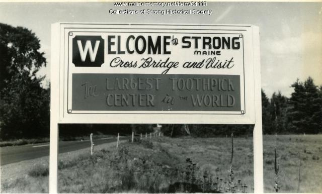
Strong, a Mussul Unsquit village - About Us - Page 2 of 3
"Carl Stinchfield's “The Bridge that Changed the Map” recounts how a $5,000 suspension bridge drove a wedge between residents in 1856 and resulted in…"
Site Page

John Martin: Expert Observer - Plan of North End of Bangor, 1844
"Since this map has a specific date, he may have recopied into the journal from earlier notes. He provided details about each building and feature…"
Site Page

John Martin: Expert Observer - Hampden, Upper and Lower corners, 1835
"… business, or resident of each building on his map. The area is as it existed in the 1830s. Martin described himself as an "expert accountant." He…"
Site Page

Strong, a Mussul Unsquit village - About Us - Page 1 of 3
"She and her students also created an interactive Google Earth map based on historical locations that are part of the Maine Memory project."
Site Page

Thomaston: The Town that Went to Sea - Thomaston Narrative
"Map of the New England Coast, 1610Maine Historical Society In 1605, after making landfall at Monhegan, Captain Waymouth re-anchored his ship…"
Site Page

Thomaston: The Town that Went to Sea - Early Wharves and Yards - 1795 to 1825
"Map of Waterfront, Thomaston, Maine 1855Thomaston Historical Society In 1823 Captain Richard Robinson acquired rights to the wharves and stores on…"
Site Page

Strong, a Mussul Unsquit village - About Us - Page 3 of 3
"… the society’s start of the yearlong Maine Memory project to research and map local homes, businesses and townspeople’s lives after the Civil War."
Site Page

Skowhegan Community History - About the Project
"… created a historic walking tour that includes a map and multimedia presentations on iPods that are available at the local Skowhegan Library."
Site Page

Thomaston: The Town that Went to Sea - Early Shipbuilders - 1780s
"… Early Shipbuilders - 1780s Map of the Georges River, Thomaston, Maine 2009Thomaston Historical Society By the time Thomaston was…"
Site Page

Thomaston: The Town that Went to Sea - Prison is Established - 1823
"Location of Maine State Prison from Early Map, Thomaston, Maine 1855Thomaston Historical Society In May of 1823, the Thomaston site was accepted as…"
Site Page
Strong, a Mussul Unsquit village - Student Research
"The 8th graders also worked on a digital map. The project topics chosen were: Our Conclusions As we looked at the lists of the hundreds of men who…"
Site Page

Islesboro--An Island in Penobscot Bay - Summer Resorts
"Summer Resorts map of Islesboro Text by Donna Seymour Seaside House Key Tag, Islesboro, ca. 1900Islesboro Historical Society Seaside…"
Site Page

Thomaston: The Town that Went to Sea - JP Cilley Ledger From Post
"… American Civil War History Timelines Battle Map Pictures. 13 Apr. 2009 <http://americancivilwar.com/statepic/alpha.html>."
Site Page

View collections, facts, and contact information for this Contributing Partner.
