Keywords: Island River
- Historical Items (278)
- Tax Records (0)
- Architecture & Landscape (0)
- Online Exhibits (48)
- Site Pages (102)
- My Maine Stories (9)
- Lesson Plans (0)
Site Pages
These sites were created for each contributing partner or as part of collaborative community projects through Maine Memory. Learn about collaborative projects on MMN.
Site Page

"… by Robin Hood, in 1675, on the Wescustogo (Royal) River, and appeared on a deed regarding land on Merriconeag Neck with Robin Hood and her brother…"
Site Page

"Namely, the Androscoggin River where the Pejepscot Proprietors sold parcels for major settlements, and the Kennebec River watershed where the…"
Site Page

"Croix River. In the Passamaquoddy language the river was known as the Skutik River. Several testimonies were given about the location of the true St."
Site Page

"Watts focused his attention on Arrowsic Island and the improvement and fortification of the land. He died in 1717 in Maine."
Site Page

"… the locative placename of the lower Androscoggin River, as Pejepscook (Pejepscot), and the upper river homeland, Ammoscongon (Amikôkan)."
Site Page

"… Proprietors? Plan of the Kennebec River describing the Plymouth patent, ca. 1719Maine Historical Society The Kennebec Proprietors traced…"
Site Page

"… and Local Reality, 1763-1842 Moose River, Moose Head Lake and Kennebeck Road, 1820Maine Historical Society Historian Francis M."
Site Page
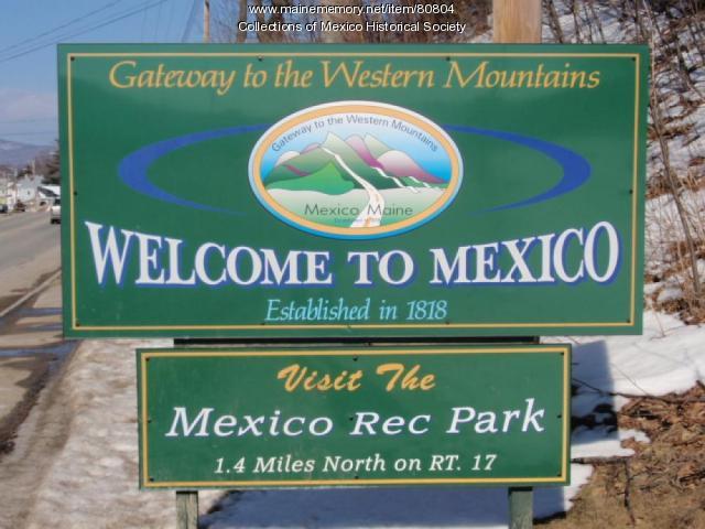
Western Maine Foothills Region - Mexico - Page 1 of 3
"… a road to the Swift River along the Androscoggin River was built and called Rumford Road, now River Road."
Site Page

"Map by Francis Joseph Neptune, Cobscook River, 1798Maine Historical Society The Beyond Borders portal makes accessible three of the Maine Historical…"
Site Page

Biddeford History & Heritage Project - HISTORY
"The coast is dotted by small, rocky islands and beaches, graceful dunes, and lush marshlands. Two long thin fingers of land create a large, naturally…"
Site Page

"For example, in a 1659 Kennebec River deed, Nanudemance retained “liberty unto me and my heirs to fish, fowl, and hunt also to set otter traps…"
Site Page

Western Maine Foothills Region - Mexico - Page 2 of 3
"Passengers then would ford the river to Peru. When the river was low, foot passengers could walk across from the island to Peru on a natural causeway."
Site Page

"… veteran, and his attempts at protecting the Sandy River; and Polin, in his attempts at protecting the Presumpscot River, both through diplomacy and…"
Site Page
"… named Paul Chadwick in 1809 along the Kennebec River sapped popular support for continued resistance, convincing most residents to finally settle…"
Site Page

"… Merrymeeting Bay, the Androscoggin and Kennebec Rivers. The eight original Pejepscot Proprietors quickly founded Brunswick and Topsham, and spent…"
Site Page

"… three million acres on both sides of the Kennebec River. In their squabbles with rival companies, they rejected what was by then a longstanding…"
Site Page

"… to Wabanaki leaders on the Androscoggin River: “Derumkin, or Daniel or Robin [ramegin]…shall come and lawfully demand and receive one Peck of Corn…"
Site Page

Beyond Borders - Mapping Maine and the Northeast Boundary - Pejepscot Proprietors Papers, 1627‐1866
"… to company activity along the Androscoggin River. Bound in volumes alongside these original manuscript records are small histories and genealogies…"
Site Page

Western Maine Foothills Region - Rumford - Page 1 of 4
"These rivers provided the opportunities for small mills to produce lumber and shingles, shovel handles, grains from the grist mills, cheese and…"
Site Page

"… four miles on either side of the Androscoggin River. Likewise, in 1719, the Muscongus Proprietors, also known as the Lincolnshire Company, began…"
Site Page

"… a number of Irish families near the Kennebec River, the British briefly flirted with the idea of transforming the Sagadahock into its own colony…"
Site Page

"… square mile region on either side of the Kennebec River. The content of this collection pre‐ and post‐dates the period of the company’s operation…"
Site Page

"The Saco River Driving Company served as the wood operation and river driving subsidiary of J. G. Deering & Son."
Site Page
Beyond Borders - Mapping Maine and the Northeast Boundary - Kennebec Proprietors Biographies
"… by reviving an old Pilgrim grant on the Kennebec River in Maine. This group of wealthy, well connected merchants organized as “The Proprietors of…"
