Keywords: Maps, Early.
- Historical Items (266)
- Tax Records (0)
- Architecture & Landscape (0)
- Online Exhibits (29)
- Site Pages (166)
- My Maine Stories (7)
- Lesson Plans (0)
Site Pages
These sites were created for each contributing partner or as part of collaborative community projects through Maine Memory. Learn about collaborative projects on MMN.
Site Page

Beyond Borders - Mapping Maine and the Northeast Boundary - Publication in Progress
"Publication in Progress This site is currently being published. Until publication is complete, you cannot make changes to the site."
Site Page
Beyond Borders - Mapping Maine and the Northeast Boundary - Publication in Progress
"Publication in Progress This site is currently being published. Until publication is complete, you cannot make changes to the site."
Site Page
Beyond Borders - Mapping Maine and the Northeast Boundary - Publication in Progress
"Publication in Progress This site is currently being published. Until publication is complete, you cannot make changes to the site."
Site Page
Beyond Borders - Mapping Maine and the Northeast Boundary - Publication in Progress
"Publication in Progress This site is currently being published. Until publication is complete, you cannot make changes to the site."
Site Page
Beyond Borders - Mapping Maine and the Northeast Boundary - Publication in Progress
"Publication in Progress This site is currently being published. Until publication is complete, you cannot make changes to the site."
Site Page
Beyond Borders - Mapping Maine and the Northeast Boundary - Publication in Progress
"Publication in Progress This site is currently being published. Until publication is complete, you cannot make changes to the site."
Site Page
Beyond Borders - Mapping Maine and the Northeast Boundary - Publication in Progress
"Publication in Progress This site is currently being published. Until publication is complete, you cannot make changes to the site."
Site Page
Beyond Borders - Mapping Maine and the Northeast Boundary - Publication in Progress
"Publication in Progress This site is currently being published. Until publication is complete, you cannot make changes to the site."
Site Page
Beyond Borders - Mapping Maine and the Northeast Boundary - Publication in Progress
"Publication in Progress This site is currently being published. Until publication is complete, you cannot make changes to the site."
Site Page

Maine's Road to Statehood - Overview: Road to Statehood
"Header image, detail of A Map of the State of Maine (1820) by Moses Greenleaf. Contributed by Osher Map Library and Smith Center for Cartographic…"
Site Page

Islesboro--An Island in Penobscot Bay - Early Settlements
"Early Settlements map of Islesboro Text by Lang Smith Big Tree, Islesboro, ca. 1920Islesboro Historical Society Islesboro was first settled…"
Site Page

Blue Hill, Maine - Shipbuilding: An Important Early Industry
"The settlement was not on the map at first because the British had found long straight trees that were good for building masts, so the map makers did…"
Site Page

Maine's Road to Statehood - The Missouri Compromise: A Moral Dilemma
"Map of the State of Maine, 1820Osher Map Library and Smith Center for Cartographic Education Within the United States, a greater sectional debate…"
Site Page

Maine's Road to Statehood - 1790s: A Growing Movement
"… effort soon died out.[16] District of Maine map, 1795 Drawn in 1795, this map promoted the separation of Maine from Massachusetts."
Site Page

"Who were the Kennebec and Pejepscot Proprietors? Brunswick Town Meeting Minutes, 1719Maine Historical Society The Pejepscot Proprietors…"
Site Page
"Who were the Kennebec and Pejepscot Proprietors? Residents on company lands also complained, with considerable justification, about suffering as a…"
Site Page

"Who were the Kennebec and Pejepscot Proprietors? Plan of the Kennebec River describing the Plymouth patent, ca."
Site Page

"Who were the Kennebec and Pejepscot Proprietors? Wabanaki deed to Richard Wharton, 1684Maine Historical Society The Pejepscot Proprietors…"
Site Page

"Who were the Kennebec and Pejepscot Proprietors? Essay by Ian Saxine, Fall 2022 Ian Saxine, PhD, is an Assistant Professor of History at…"
Site Page
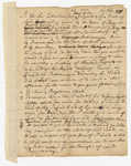
"Who were the Kennebec and Pejepscot Proprietors? Coll. 61, vol. 7, pg. 401 Example of a proprietor meeting at the Royall Exchange Tavern on King…"
Site Page

"Beyond Borders: an historical overview This improvisational system for claiming land as legal property sprouted a thicket of conflicts."
Site Page

"Beyond Borders: an historical overview Before the Seven Years War (1756-1763), the land companies’ efforts to coax Scotch-Irish migrants and New…"
Site Page

"Wabanaki Agency in the Proprietor Records Acknowledgement In the twenty-first century, historians and tribal scholars have turned to these…"
Site Page

"Wabanaki Agency in the Proprietor Records Kinship and Leadership Copy, deed from James and Rachell Berry to Proprietors, page 1 of 3Maine…"
