Keywords: Mile 1
- Historical Items (673)
- Tax Records (12)
- Architecture & Landscape (5)
- Online Exhibits (54)
- Site Pages (77)
- My Maine Stories (11)
- Lesson Plans (0)
Site Pages
These sites were created for each contributing partner or as part of collaborative community projects through Maine Memory. Learn about collaborative projects on MMN.
Site Page

Historic Hallowell - Ice Storm Day 1
"… Mountains were covered by heavy ice, blocking 850 miles of trails and roads. All that ice from the storm destroyed power lines, which caused tons…"
Site Page

Scarborough: They Called It Owascoag - Historical Overview - Page 1 of 4
"… another settlement was established about three miles up river on a 1,000-acre tract of land owned by the Alger brothers."
Site Page

Life on a Tidal River - Early Railroads in Bangor - Page 1 of 2
"… a short line chartered March 1, 1870 to run 18.8 miles from Bangor to Bucksport. The line was surveyed in the fall of 1872, and construction began…"
Site Page

Life on a Tidal River - The Bangor Fire of 1911 - Page 1 of 2
"… April thirtieth day Down in Bangor city Not many miles away? (Young 1) Fairbanks Building on fire, Bangor, 1911Bangor Public Library One of…"
Site Page
Scarborough: They Called It Owascoag - Maritime Tales: Shipyards and Shipwrecks - Page 1 of 2
"Since it was three miles up the river from the coastline, Dunstan Landing was a fairly inconspicuous place and less exposed to attack by the British."
Site Page

Lubec, Maine - Building the Roosevelt Bridge to Campobello - Page 1 of 3
"Roosevelt’s long time summer home, lies 10 miles across open ocean from mainland New Brunswick. But a mere 300 yards from the U.S."
Site Page

Swan's Island: Six miles east of ordinary - Resources
"… Small, H. W. A History of Swan's Island, Maine . 2001 ed."
Site Page

Presque Isle: The Star City - Northern Maine Fair Memories - Page 1 of 3
"… went in the car to the fair, which was about four miles from her house in the country. Dorothy got involved with harness racing because her husband…"
Site Page

Strong, a Mussul Unsquit village - About Us - Page 1 of 3
"… Land Trust and High Peaks Alliance and a new 45-mile Fly Rod Crosby Trail. Ben assisted teacher Crystal Knapp Polk with class mapping activities in…"
Site Page
"… Oldham, "containing in breadth by the sea four miles, and eight miles up to the mainland." The interior lands were referred to at that time as east…"
Site Page

"… Proprietors "Voted that Two Town Each of five Miles on the R Kennebeck & fifteen Miles Back..."Maine Historical Society The Kennebec Proprietors…"
Site Page

Life on a Tidal River - Three Civil War Letters - Page 1 of 4
"… from Ft Corcoran, and is now encamped about 4 Miles from Monsons Hill and I shall go and see them at the first opportunity."
Site Page

Western Maine Foothills Region - For The Love Of Paper - Page 1 of 4
"… guides and souvenir books of travel over 5,000 miles of rail and steamship lines. They had over 200 uniformed employees covering the rails from…"
Site Page
"By this time they had a railroad that stretched a mile long complete with cars and 30 ton engine to accomodate their huge business."
Site Page

View collections, facts, and contact information for this Contributing Partner.
Site Page

Blue Hill, Maine - Long Island: The Forgotten Community - Page 2 of 3
"Long Island is 4 and 1/2 miles long and 2 miles wide. In 1768 the island had a sawmill, and settlement began by 1779."
Site Page
Presque Isle: The Star City - State Street Baptist Church
"… congregation met in an old school building three miles south of town on the Houlton Road. The pastor at that time was Joseph Roberts."
Site Page

Historic Hallowell - Nature's Bounty - Raw Material, Close at Hand
"The 2 1/2 mile route along Outer Winthrop Street contained wetland and a steep grade. Granite slab in transit, Hallowell, ca."
Site Page

View collections, facts, and contact information for this Contributing Partner.
Site Page

"… Androscoggin, including Amitgonpontekok (Twenty Miles Falls), which divided Pejepscook from Ammoscongon."
Site Page

Farmington: Franklin County's Shiretown - Measuring Rock
"Each lot was 100 rods long and extended 1 mile from the river. Stephen Titcomb’s lot was the most northern of the six."
Site Page

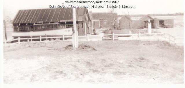
Scarborough: They Called It Owascoag - Transportation Through the Years - Page 4 of 4
"… voted to limit the speed of automobiles to eight miles an hour. By the spring of 1912, an automobile craze had hit the state and the number of cars…"
Site Page

Presque Isle: The Star City - Aroostook Valley Railroad
"In 1911, an additional 11.3 miles were laid to reach New Sweden. With the approval of 7.13 miles on June 29, 1912, the city of Caribou was joined…"
Site Page

Swan's Island Historical Society
View collections, facts, and contact information for this Contributing Partner.
