Keywords: Surveys
- Historical Items (545)
- Tax Records (4)
- Architecture & Landscape (141)
- Online Exhibits (30)
- Site Pages (92)
- My Maine Stories (2)
- Lesson Plans (0)
Site Pages
These sites were created for each contributing partner or as part of collaborative community projects through Maine Memory. Learn about collaborative projects on MMN.
Site Page

Beyond Borders - Mapping Maine and the Northeast Boundary - People
"People Explore essays pertaining to individuals, communities, and key players across the Pejepscot and Kennebec Proprietors, and the Northeast…"
Site Page

Beyond Borders - Mapping Maine and the Northeast Boundary - Kennebec Proprietors Biographies
"Kennebec Proprietors Biographies The Kennebec Proprietors came into being in 1749, when an association of Boston Merchants jumped into the land…"
Site Page

"The Shaping of the Borderlands: Arcane Deeds and Failed Colonies Islands in Passamaquoddy Bay, ca."
Site Page

"The Shaping of the Borderlands: Arcane Deeds and Failed Colonies Nova Scotia was re-created as an independent British colony following the British…"
Site Page

"The Shaping of the Borderlands: Arcane Deeds and Failed Colonies Boundary between United States and New Brunswick, undatedMaine Historical…"
Site Page

"The Plymouth Company (Kennebec Proprietors) records, ca. 1625-1824 Kennebec Purchase Deed, October 27, 1661Maine Historical Society The…"
Site Page

"Passamaquoddy Hereditary Chief Francis Joseph Neptune Essay by Donald Soctomah Description of Pagan and Chipman’s Meetings with Francis Joseph…"
Site Page

Boothbay Region Historical Society
View collections, facts, and contact information for this Contributing Partner.
Site Page
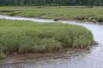
Scarborough: They Called It Owascoag - Scarborough Marsh: "Land of Much Grass" - Page 4 of 4
"“An Inter-tidal Survey of the Scarborough Marsh.” (Copy of article provided by B. Robinson.) Sebold, Kimberly."
Site Page

Farmington: Franklin County's Shiretown - John Frank Stevens
"… tasks in the field began easy at first, simply surveying fields and prospective sites. After two years of doing this in the Minneapolis city…"
Site Page
Farmington: Franklin County's Shiretown - Measuring Rock
"In 1780, the first surveyors came to survey the land of the new Farmington establishment. It turned out that the first six lots were done exactly…"
Site Page

New Portland: Bridging the Past to the Future - Bridges of East New Portland
"… in the state, and was determined eligible for listing in the National Register of Historic Places by Maine DOT's Historic Bridge Survey in 2001."
Site Page

Bath's Historic Downtown - Project Resources
"Sagadahoc Preservation Inc. House Survey Vertical Files (Subject and Biography): Clippings, research notes, copied articles."
Site Page

View collections, facts, and contact information for this Contributing Partner.
Site Page

Western Maine Foothills Region - Buckfield
"In 1785, the townspeople took a survey and decided to purchase the land from Massachusetts for two shillings an acre."
Site Page

Maine's Swedish Colony, July 23, 1870 - The Coming of the Swedes, 1870-73
"… In 1870, the original 160-acre lots were re-surveyed and made into 100-acre lots. The plan of the Immigration Board representative, Mr."
Site Page

"Purchases land in North Lubec 1795 • Cushing survey of North Lubec completed – lots assigned to settlers on payment of $5 1797 • Daniel Ramsdell…"
Site Page

Maine's Swedish Colony, July 23, 1870 - The Colony Continues to Grow, 1874 - 1900
"… half of T16-R3 (what would become Stockholm) was surveyed for settlers in 1879 and again in 1883 when it was sold to the Burleigh heirs by the…"
Site Page

Western Maine Foothills Region - Dixfield - Page 1 of 5
"Land speculators swarmed all over Maine surveying its natural resources. They plotted access to the Boston markets through Maine’s rivers and ports."
Site Page

View collections, facts, and contact information for this Contributing Partner.
Site Page

Lubec, Maine - Building the Roosevelt Bridge to Campobello - Page 1 of 3
"First steps after site selection and surveying involved clearing standing structures. Building demolition, Lubec, ca."
Site Page

Presque Isle: The Star City - Aroostook Valley Railroad
"The initial survey was submitted and approved on May 6, 1903. Permission was also granted for the Aroostook Valley Railroad to connect with both the…"
Site Page

Life on a Tidal River - Early Railroads in Bangor - Page 1 of 2
"The Chief Engineer, Joseph W. Taney, and his crew surveyed the route and began construction. The company ran short of funds and the building ceased."
Site Page
Farmington: Franklin County's Shiretown - Brief History
"In 1780 Joseph North formalized the survey of the area. The innovative founders in 1776, lacking a “chain”, the tool used to measure land, staked out…"
