Keywords: maps
- Historical Items (953)
- Tax Records (0)
- Architecture & Landscape (275)
- Online Exhibits (36)
- Site Pages (267)
- My Maine Stories (8)
- Lesson Plans (6)
Site Pages
These sites were created for each contributing partner or as part of collaborative community projects through Maine Memory. Learn about collaborative projects on MMN.
Site Page

Blue Hill, Maine - Shipbuilding: An Important Early Industry
"The settlement was not on the map at first because the British had found long straight trees that were good for building masts, so the map makers did…"
Site Page
Lincoln, Maine - Aroostook War
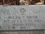
"Aroostook War Map X To prove this statement with research, I found that Canada would have gotten its way if Maine did not stand up and create a…"
Site Page

Cumberland & North Yarmouth - Our Shared History - Page 2 of 4
"Cumberland Map X Cumberland’s Secession: 1821 This church split foreshadowed the secession of the town of Cumberland from North Yarmouth, which…"
Site Page

Cumberland & North Yarmouth - Our Shared History - Page 1 of 4
"Our Shared History Map of North Yarmouth, 1687Maine Historical Society From One Town, Many: Ancient North Yarmouth We are now two separate…"
Site Page
Surry by the Bay - Early Settlement
"1880Maine Historical Society Border Dispute Originally, Surry extended to the Union River and north to Ellsworth Falls. On an early settler map of…"
Site Page

Islesboro--An Island in Penobscot Bay - Early Settlements
"Early Settlements map of Islesboro Text by Lang Smith Big Tree, Islesboro, ca. 1920Islesboro Historical Society Islesboro was first settled…"
Site Page

Mount Desert Island: Shaped by Nature - The Savage Family of Mount Desert
"… of original correspondence, photographs, maps, written and oral histories, business records, and ephemera to develop our exhibits."
Site Page

Mount Desert Island: Shaped by Nature - Early Settlement
"… Library Northeast Harbor Section of 1807 Map by James and John PetersNortheast Harbor Library Climena Roberts Savage…"
Site Page

"Northeast Harbor Village Map, ca. 1955Northeast Harbor Library The Future That Northeast Harbor is in economic decline, there is no doubt."
Site Page

Historic Hallowell - Hallowell History From a 7th Grade Perspective
"… X This year's plethora of information included maps, a ships manifest, newspaper articles, history of the Vaughan Woods and Homestead, annual…"
Site Page

Islesboro--An Island in Penobscot Bay - Water Transportation
"The Smith herself cost $3 million. This ferry, still in service, can carry 250 passengers and 33 cars. map of Islesboro "
Site Page

Thomaston: The Town that Went to Sea - Henry Knox: Land Dealings
"Map of the Waldo Patent, 1786The General Henry Knox Museum One of Knox’s businesses was land speculation."
Site Page

Thomaston: The Town that Went to Sea - Shipbuilding Industry Expands - 1850 to 1857
"… Industry Expands - 1850 to 1857 Map of Waterfront, Thomaston, Maine 1855Thomaston Historical Society In 1853 Alexander McCallum and E. S…"
Site Page

Thomaston: The Town that Went to Sea - Early History - 1719 to 1740
"Map of Lincoln, Thomaston, Maine in 1719Thomaston Historical Society Throughout Lovewell’s War, 1721-1726, the Indians and their French allies again…"
Site Page

Thomaston: The Town that Went to Sea - Thomaston is Incorporated - 1777
"… is Incorporated - 1777 District of Maine map, 1795Maine Historical Society Local settlers cultivated potatoes and vegetable gardens, hunted…"
Site Page

Cumberland & North Yarmouth - Resources and Links
"… business directory of the subscribers to the new map of Maine : with a brief history and description of the state. Portland, Maine : J."
Site Page

View collections, facts, and contact information for this Contributing Partner.
Site Page

Hamlin Memorial Library and Museum
View collections, facts, and contact information for this Contributing Partner.
Site Page

View collections, facts, and contact information for this Contributing Partner.
Site Page

View collections, facts, and contact information for this Contributing Partner.
Site Page

View collections, facts, and contact information for this Contributing Partner.
Site Page

Frye Island Historical Society
View collections, facts, and contact information for this Contributing Partner.
Site Page

Islesboro--An Island in Penobscot Bay - Schools
"Schools map of Islesboro Text by Ruth Hartley School Bell, Islesboro, ca. 1880Islesboro Historical Society After incorporating as a town in…"
Site Page

Lubec, Maine - Klondike: Lubec's Gold from Sea Water Hoax
"Map of Klondike Plant #2 This map showing the location of Plant #2 on the North Lubec Canal appears on the back cover of the Prospectus for the…"
